
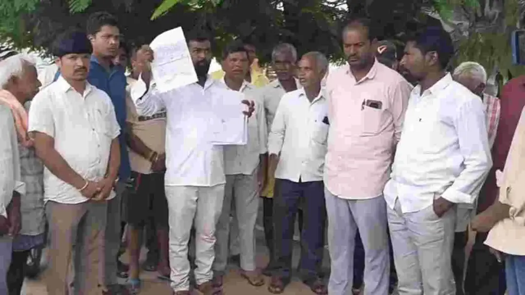
Notices issued to farmers in Erravalli survey number 325
Revenue officials served notices on Saturday to 100 farmers recorded in survey number 325, covering 388.05 acres in Erravalli village of Markook mandal, Siddipet district. Markook tahsildar Sarita issued them on the district collector's orders. A farmer-wise survey begins on September 21, with farmers asked to produce evidence of how they acquired the land. The DGPS boundary survey is complete and a map is being prepared. Venkatapur farmers alleged their land was merged into the Erravalli survey number and submitted documents.
Source
Andhra Jyothy (ఆంధ్రజ్యోతి) · read the original report ↗
Desk check · some claims need care
What the desk checked (5)
- Notices were issued to 100 farmers recorded in survey number 325 covering 388.05 acres in Erravalli village, Markook mandal, Siddipet district. — Attributed in source to Markook tahsildar Sarita acting on district collector's orders; figures appear in source.
- Farmer-wise survey will begin from September 21, with farmers required to attend and produce title evidence. — Stated in the notices as reported by the source; date appears in source.
- DGPS satellite boundary survey of the 388.05 acres was completed Friday, with remaining coordinates collected Saturday from 8 am. — Attributed to ongoing official survey work; no independent confirmation in source.
- Venkatapur farmers allege their land was merged into Erravalli survey number 325 and boundaries changed under the previous government. — Allegation by unnamed farmers; documents submitted to the tahsildar but claim unverified in source.
- Farmers said CM Revanth Reddy's announcement gave them confidence of justice. — Paraphrased farmer statement; the content of the CM's announcement is not detailed in the source.
Analysts’ view opinion
Errawalli's Survey No. 325 is no longer just a revenue exercise — it has become a politically loaded case in Siddipet district. Notices to 100 recorded farmers on the collector's orders, a completed DGPS boundary survey, and a fixed date for the farmer-wise enjoyment survey all suggest the administration wants this moved fast and visibly. With Venkatapur farmers alleging that survey numbers and village boundaries were altered "under the previous government" and submitting documents to back it, the matter is clearly capable of shifting from administrative verification to political contest — though nothing in this story establishes those allegations as proven.
- The chain from collector's orders to tahsildar-level notice delivery signals unusual administrative priority for a single survey number.
- Requiring farmers to prove how they acquired the land puts the validity of past records itself under scrutiny — politically sensitive ground.
- Venkatapur farmers invoking the Chief Minister's announcement as the basis for their confidence indicates potential farmer goodwill accruing to the ruling side on this issue.
- Because the allegation is framed as having occurred "under the previous government", a counter-narrative of political vendetta from the opposition is a live possibility; no opposition response is recorded in this story.
- With the 100 recorded farmers and the Venkatapur claimants having competing interests, whichever way the survey lands, some local resentment is likely.
What to watch — Watch the farmer-wise survey from the 21st, how the old map reconciles with the new boundary map, whether Venkatapur farmers actually receive notices, and how opposition leaders respond.
The story does not establish that survey numbers or boundaries were in fact altered, by whom, or with whose involvement — these remain farmers' allegations and an ongoing verification process.
Deep dive
Research brief · 8 facts · 4 dates · exam-readyThe brief
Context
Survey number 325 in Erravalli village of Markook mandal, Siddipet district, Telangana, covering 388.05 acres, is under a fresh official land survey ordered by the district collector. Revenue officials are verifying how the 100 farmers recorded in the land records acquired their holdings, using a satellite-based DGPS boundary survey followed by a farmer-wise enjoyment survey and sub-division. The exercise has also drawn farmers from the neighbouring hamlet of Venkatapur, who allege their land boundaries and survey numbers were altered under the previous government and merged into Erravalli's survey number 325.
Key facts
- Survey number 325 in Erravalli village, Markook mandal, Siddipet district, covers 388.05 acres of land under scrutiny.
- Markook tahsildar Sarita issued notices to 100 farmers recorded in the land records on Saturday, on the district collector's orders.
- Notices were handed over at the gram panchayat office; those not served will get them at home or via the panchayat notice board.
- Farmer-wise survey begins from the 21st of the month; every farmer must attend, produce evidence of how the land came to them and point out boundaries.
- The satellite (DGPS) boundary survey of the 388.05 acres was completed on Friday; leftover patches were covered from 8 am Saturday by collecting coordinates.
- The map for survey number 325 is being prepared at the district collectorate under district survey department AD Sudarshan; it will be matched with the old map.
- Venkatapur farmers listed disputed extents in their village: 27.23 acres in survey no. 41, 73.12 acres in no. 85, 6.28 acres in no. 88, 9 acres in no. 89, 2 acres in no. 100, plus government land in nos. 101 and 162.
- After the enjoyment survey, farmer-wise sub-division of the land is to be carried out.
Timeline
- Thursday (first day, as reported)Officials began the survey of survey number 325 in Erravalli.
- FridaySatellite (DGPS) boundary survey of the 388.05 acres completed.
- Saturday (September 19 report)Third day of survey; leftover coordinates collected from 8 am; notices served on 100 farmers; Venkatapur farmers submitted documents to the tahsildar.
- September 21Farmer-wise survey to begin, with farmers required to attend with evidence of land acquisition.
Who has a stake
- 100 farmers recorded in survey number 325, Erravalli — Must prove with documents how they acquired their land; holdings to be matched, verified and sub-divided.
- Farmers of Shivaru Venkatapur village — Allege their land was taken over and boundaries and survey numbers changed; seeking restoration and justice.
- Markook tahsildar Sarita — Issuing notices and receiving evidence from farmers as per the collector's orders.
- Siddipet district collector — Ordered the notices and oversees the survey process.
- District survey department (AD Sudarshan) — Preparing the boundary map at the collectorate and reconciling it with the old map.
- Chief Minister Revanth Reddy — His announcement has raised farmers' expectations that justice will be delivered in the land dispute.
Why it matters
Land records disputes over boundaries and survey numbers directly decide ownership, compensation and credit access for small farmers. The Erravalli exercise shows how satellite-based surveys and document verification are being used to reconstruct altered records, while allegations from Venkatapur farmers point to how boundary changes can erase a village's claim to land. The outcome will set expectations for similar record-correction demands elsewhere in Telangana.
UPSC angle
Prelims pointers
- Erravalli village lies in Markook mandal of Siddipet district, Telangana.
- Survey number 325 in Erravalli covers 388.05 acres; notices were served on 100 recorded farmers.
- DGPS (Differential Global Positioning System) satellite survey was used for the boundary survey.
- A tahsildar is the mandal-level revenue officer; Markook's tahsildar is Sarita.
- Sequence followed: boundary survey, map matching with old map, farmer-wise enjoyment survey, then sub-division.
Mains framing
The Erravalli case illustrates the core weakness of Indian land administration: records of rights, maps and survey numbers that can diverge from actual possession, and can allegedly be altered administratively, as Venkatapur farmers claim happened when their boundaries were merged into Erravalli's survey number 325. The state's response combines technology and documentary verification: a DGPS satellite boundary survey of the 388.05 acres, preparation of a fresh map at the collectorate and its reconciliation with the old map, followed by a farmer-wise enjoyment survey in which each of the 100 recorded farmers must show how the land devolved to them, ending in sub-division. The implications are significant for tenure security, since sub-division and reconciled maps create a defensible record, but the process also places the burden of proof on farmers who may lack old documents. A credible way forward, as suggested by the process described in the source, lies in serving notice to all affected parties including neighbouring villages, examining the evidence they submit, and transparently publishing survey outcomes so that boundary corrections are settled on record rather than by administrative fiat.
Key terms
- Survey number
- The unique number assigned to a parcel of land in revenue records and village maps, used to identify ownership and extent.
- DGPS survey
- Satellite-based Differential GPS method used here to fix precise coordinates and demarcate land boundaries.
- Enjoyment survey
- Survey to record who is actually in possession and cultivating the land, compared against the documentary record.
- Sub-division
- Splitting a larger survey number into individual farmer-wise parcels with distinct numbers and boundaries.
- Tahsildar
- Mandal-level revenue officer responsible for land records, notices and revenue administration.
Practice questions
- Discuss how technology-driven land surveys such as DGPS-based boundary mapping can strengthen land records, using the Erravalli survey number 325 exercise as an illustration.
- Alterations in village boundaries and survey numbers can dispossess farmers without formal transfer of title. Examine, with reference to the Venkatapur farmers' allegations, the safeguards needed in revenue administration.
- What is an enjoyment survey, and why is matching current possession with documentary evidence of devolution essential before farmer-wise sub-division of land?
Grounded only in the source report — figures and dates are the source's, not inferred.