
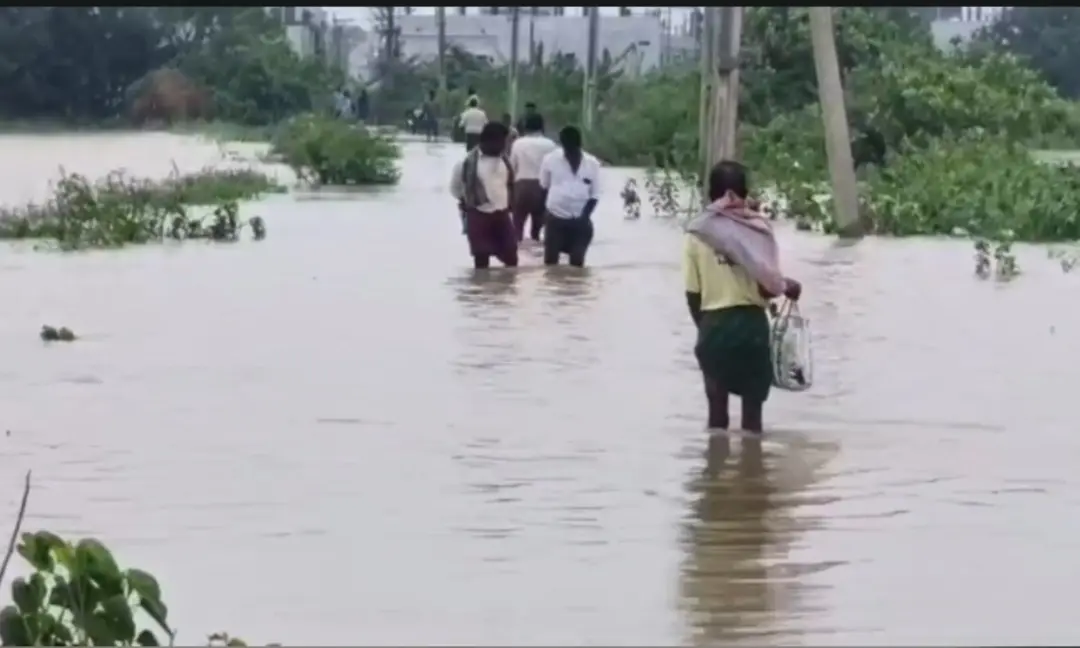
Suddagadda stream overflows at Gollaprolu, crop fields submerged
Heavy rain under the influence of a low-pressure system over the Bay of Bengal has left the Suddagadda stream flowing in spate at Gollaprolu in Kakinada district, submerging several areas and crop fields. Farmers said standing crops are under water and there is a risk of losses. Residents fear the inundation could worsen if the rain continues. Farmers have asked officials to inspect the flooded areas, assess crop loss and provide relief.
Source
Kakinada — వార్తలు · read the original report ↗
Desk check · compared with the source
What the desk checked (5)
- Heavy rain caused by a low-pressure system over the Bay of Bengal is lashing the area — Stated in source as the cause; no meteorological department attribution given.
- Suddagadda stream at Gollaprolu is flowing in spate, submerging several areas and crop fields — Appears in source as reported observation; no official confirmation cited.
- Standing crops are under water and farmers fear losses — Attributed to farmers; no quantified damage estimate in source.
- Inundation could worsen if rain continues — Attributed to local residents as an apprehension, not a forecast.
- Farmers want officials to inspect flooded areas, assess crop loss and provide relief — Attributed to farmers as a demand; no official response recorded in source.
Analysts’ view opinion
This reads as a weather story, but its politics are unmistakable. In coastal Andhra, inundation and crop loss routinely become a test of administrative responsiveness — how fast enumeration happens and how quickly compensation reaches hands will decide the political scoreline. The fact that farmers are already demanding that officials come and assess losses signals that pressure on the local administration has begun.
- In farm-dependent constituencies like Gollaprolu, crop-loss assessment and compensation tie directly to the ruling party's local standing.
- For the government, early visible response is an opportunity to build goodwill; delay converts the same situation into ammunition for the opposition.
- If stream overflow and flooding are recurring here, the longer-term critique about drain and stream desilting and maintenance is likely to resurface.
- Field visits and photo-ops are standard at this stage, but farmers measure outcomes in input-subsidy figures, not inspections.
- If rains persist, this could scale from a mandal-level grievance into a district or state-level political talking point.
What to watch — Watch when officials actually begin field inspection and crop-loss enumeration, and how quickly elected representatives show up in the affected pockets.
The story does not establish the extent of crop damage, any monetary estimate, or any response from the government or political parties — all of that remains unconfirmed.
Deep dive
Research brief · 7 facts · 3 dates · exam-readyThe brief
Context
A low-pressure system over the Bay of Bengal has been bringing heavy rain to coastal Andhra Pradesh. In Kakinada district, the Suddagadda stream (vagu) at Gollaprolu is flowing in spate, and the overflow has submerged several localities and standing crop fields. Farmers, fearing crop loss, are seeking official inspection, damage assessment and relief. The report is dated 25 September 2026.
Key facts
- Heavy rain under the influence of a low-pressure system over the Bay of Bengal is the stated cause of the flooding.
- The Suddagadda stream at Gollaprolu, Kakinada district, is flowing in spate (uddhrutamga).
- Several areas and crop fields have been submerged by the overflowing stream.
- Farmers say crops already standing in the fields are under water, raising the risk of crop losses.
- Residents fear the severity of inundation will increase if the rain continues.
- Farmers have demanded that officials inspect the inundated areas, assess crop loss and support them with relief.
- The report was published on 25 September 2026 at 1:03 PM IST, datelined Kakinada.
Timeline
- Days preceding 25 September 2026 (as reported)A low-pressure system forms over the Bay of Bengal, triggering heavy rainfall in the region.
- 25 September 2026Suddagadda stream flows in spate at Gollaprolu; several areas and crop fields reported submerged and farmers raise alarm.
- 25 September 2026 (same day)Farmers appeal to officials to inspect flooded areas, estimate crop loss and provide relief.
Who has a stake
- Farmers of Gollaprolu — Standing crops are submerged; face possible crop loss and need enumeration of damage and compensation.
- Residents of affected areas in Gollaprolu — Face worsening inundation of localities if rainfall continues.
- District administration / revenue and agriculture officials, Kakinada district — Expected to inspect inundated areas, assess crop loss and extend relief.
- Kakinada district (Andhra Pradesh) — Area affected by heavy rain and stream flooding linked to the Bay of Bengal low-pressure system.
Why it matters
Low-pressure systems over the Bay of Bengal routinely bring intense rain to coastal Andhra Pradesh late in the monsoon, and small streams like the Suddagadda can overflow quickly into fields and habitations. Because the flooding hits standing crops close to harvest, the speed of official inspection and crop-loss enumeration determines whether affected farmers get timely relief.
UPSC angle
Prelims pointers
- Suddagadda is a stream (vagu) that flooded at Gollaprolu in Kakinada district, Andhra Pradesh.
- The flooding is attributed to heavy rain from a low-pressure system over the Bay of Bengal.
- Gollaprolu lies in Kakinada district, formed in Andhra Pradesh's coastal belt; the report is dated 25 September 2026.
- Crop loss relief follows official inspection and assessment (enumeration) of damage by district officials.
- Late-September low-pressure systems in the Bay of Bengal are a recurring source of heavy rain over coastal Andhra Pradesh.
Mains framing
Localised flooding at Gollaprolu illustrates how a Bay of Bengal low-pressure system translates, within hours, into agrarian distress: heavy rain swells a small stream such as the Suddagadda, which overtops into habitations and submerges standing crops. The immediate cause reported is rainfall intensity, but the vulnerability lies in low-lying fields adjoining stream courses and in the absence of adequate drainage capacity, which means inundation deepens if rain persists, as residents fear. The implications are economic, since submergence at the standing-crop stage can wipe out a season's income, and administrative, since relief depends entirely on prompt field inspection and crop-loss enumeration by revenue and agriculture staff, which is precisely what farmers here are demanding. A grounded way forward, consistent with what the source reports, involves speedy inspection of inundated pockets, transparent assessment of crop damage, and timely support to affected farmers, along with continued monitoring of the stream while rainfall continues. Beyond this episode, the recurring pattern argues for anticipatory action whenever a low-pressure system is flagged over the Bay of Bengal.
Key terms
- Low-pressure system (alpapeedanam)
- A zone of low atmospheric pressure, here over the Bay of Bengal, that draws in moist air and produces heavy rainfall over adjoining coasts.
- Suddagadda vagu
- The stream at Gollaprolu that is flowing in spate and has spilled into surrounding areas and crop fields.
- Gollaprolu
- The locality in Kakinada district, Andhra Pradesh, where the stream overflow has submerged areas and fields.
- Crop loss assessment
- The official estimation of damage to submerged crops that farmers say must precede relief to affected cultivators.
- Inundation (mumpu)
- Submergence of land and habitation by floodwater; locals fear its severity will rise if rain continues.
Practice questions
- How do low-pressure systems over the Bay of Bengal affect rainfall and flooding patterns in coastal Andhra Pradesh? Illustrate with the Gollaprolu episode.
- Discuss the administrative steps required between a flood event and the disbursal of crop-loss relief to farmers. What causes delays?
- Small streams and local drainage, rather than major rivers, often cause agricultural submergence. Examine the implications for flood management planning at the district level.
Grounded only in the source report — figures and dates are the source's, not inferred.