
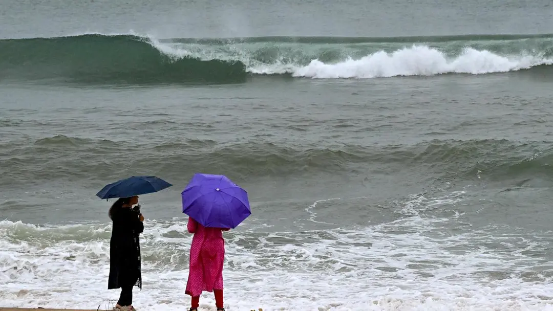
Bay of Bengal depression to cross coast on September 23 night
The depression over the Bay of Bengal is likely to intensify into a deep depression and cross the north Andhra Pradesh–south Odisha coast between Visakhapatnam and Gopalpur on the night of September 23 and early hours of September 24, the IMD said. At 8.30 a.m. Tuesday it lay about 290 km east of Visakhapatnam. Palasa recorded 100 mm rain, Madhurawada 66 mm. Schools in four districts are closed Wednesday; fishermen advised ashore till September 25.
Source
The Hindu — Andhra Pradesh · read the original report ↗
Desk check · compared with the source
What the desk checked (5)
- Depression over Bay of Bengal to intensify into a deep depression and cross the north Andhra Pradesh–south Odisha coast between Visakhapatnam and Gopalpur on the night of September 23 and early hours of September 24. — Attributed to an IMD special bulletin issued by the Cyclone Warning Centre, Visakhapatnam, around 4.30 p.m. on Tuesday.
- At 8.30 a.m. Tuesday the system was centred near 17.9°N, 86.0°E, about 290 km east of Visakhapatnam and 200 km southeast of Gopalpur. — Coordinates and distances appear in the source, attributed to IMD.
- Palasa in Srikakulam received 100 mm rainfall between 8.30 a.m. and 6 p.m.; Madhurawada recorded 66 mm, the highest in Visakhapatnam district. — Figures stated in source, credited to data on government weather platforms.
- Holidays declared for schools in Visakhapatnam, Anakapalli, Srikakulam and Alluri Sitharama Raju districts on September 23. — Stated in source; no issuing authority named for the order.
- Fishermen advised not to venture into the sea till September 25; Cautionary Signal No. III hoisted at five ports. — Attributed to IMD advisory in the source.
Analysts’ view opinion
This is a weather story, but in Andhra Pradesh any system crossing the Uttarandhra coast quickly becomes a test of administrative competence. Declaring school holidays in advance for Wednesday and having the Home and Disaster Management Minister, V. Anitha, direct districts to stay alert reflect the politically safe route: show maximum preparedness, invite minimum criticism. Whether that preparedness earns political credit will depend on the scale of damage after landfall and the speed of relief.
- Pre-emptive holidays in Visakhapatnam, Anakapalli, Srikakulam and Alluri Sitharama Raju districts are the classic low-risk call governments make to avoid being accused of underestimating a threat.
- By issuing directions herself, the Home and Disaster Management Minister gives the response a visible political face — which also means credit if it goes well and accountability if gaps emerge.
- The advisory keeping fishermen off the sea till September 25 has a direct economic cost for coastal communities, and demands for compensation and relief typically follow quickly in this constituency-sensitive belt.
- With Srikakulam, Vizianagaram and the Agency areas among the worst hit, the state's political conversation could again turn to drainage, infrastructure and disaster-preparedness spending in north coastal Andhra.
- Once the system crosses, field visits, damage assessments and requests for central assistance usually become the immediate arena of competition between the ruling party and the opposition.
What to watch — Watch the first 48 hours after landfall: how fast damage assessments, compensation announcements and any appeals for central assistance come, and which gaps the opposition chooses to highlight.
The story covers only warnings and precautionary steps — it does not establish the extent of damage, whether the response proved adequate, or that any political criticism has been made.
Deep dive
Research brief · 8 facts · 7 dates · exam-readyThe brief
Context
A low-pressure system classified as a depression over the west-central and adjoining northwest Bay of Bengal is moving towards the north Andhra Pradesh–south Odisha coast. The India Meteorological Department's Cyclone Warning Centre in Visakhapatnam has forecast that it will intensify into a deep depression and make landfall between Visakhapatnam and Gopalpur on the night of September 23 and early hours of September 24. Uttarandhra (north coastal Andhra Pradesh) already received widespread rains on Tuesday, September 22, prompting school holidays in four districts and fishing restrictions along the coast.
Key facts
- At 8.30 a.m. on Tuesday, September 22, the depression was centred near latitude 17.9° N, longitude 86.0° E — about 290 km east of Visakhapatnam and 200 km southeast of Gopalpur (Odisha).
- The system was also about 200 km east-southeast of Kalingapatnam (AP) and 210 km south of Puri (Odisha).
- The depression moved west-northwestward at about 18 km/h during the six hours before the IMD special bulletin issued around 4.30 p.m. on Tuesday.
- IMD said the system was very likely to intensify into a deep depression over the west-central and adjoining northwest Bay of Bengal within the next 12 hours.
- Palasa in Srikakulam district recorded 100 mm of rainfall between 8.30 a.m. and 6 p.m. on Tuesday.
- In Visakhapatnam district, Madhurawada recorded the highest rainfall at 66 mm, followed by Gambheeram (63 mm) and Padmanabham (61 mm); Bhogapuram in Vizianagaram recorded 63 mm.
- Fishermen have been advised not to venture into the sea along the Andhra Pradesh coast till September 25; the sea is likely to remain very rough till September 24.
- Local Cautionary Signal No. III has been hoisted at Kalingapatnam, Bheemunipatnam, Visakhapatnam, Gangavaram and Kakinada ports.
Timeline
- 8.30 a.m., September 22Depression centred at 17.9° N, 86.0° E, about 290 km east of Visakhapatnam.
- 8.30 a.m. to 6 p.m., September 22Palasa records 100 mm rain; waterlogging in Palasa and Kasibugga; heavy rain across Srikakulam, Visakhapatnam, Vizianagaram and Agency areas.
- Around 4.30 p.m., September 22IMD's Cyclone Warning Centre, Visakhapatnam, issues special bulletin noting westward-northwestward movement at 18 km/h.
- September 23 (Wednesday)Holidays declared for schools in Visakhapatnam, Anakapalli, Srikakulam and Alluri Sitharama Raju districts.
- Night of September 23 to early hours of September 24System, as a deep depression, likely to cross the coast between Visakhapatnam and Gopalpur.
- Till September 24Sea likely to remain very rough along the Andhra Pradesh coast.
- Till September 25Fishermen advised against venturing into the sea.
Who has a stake
- India Meteorological Department / Cyclone Warning Centre, Visakhapatnam — Issues track forecasts, special bulletins, port cautionary signals and heavy rain warnings that drive district-level precautions.
- Residents and commuters of Visakhapatnam, Srikakulam and Vizianagaram — Face waterlogged roads, traffic disruption and inundation, as seen at Kasibugga Junction, Railway Gate, Seethammadhara and Gajuwaka.
- Fishermen along the Andhra Pradesh coast — Loss of fishing days as they are barred from the sea till September 25 amid very rough sea conditions.
- School students and parents in four districts — Schools closed on September 23 in Visakhapatnam, Anakapalli, Srikakulam and Alluri Sitharama Raju districts.
- Andhra Pradesh Home and Disaster Management Minister V. Anitha — Directed officials in all districts to stay alert and take precautionary measures ahead of landfall.
- Ports of Kalingapatnam, Bheemunipatnam, Visakhapatnam, Gangavaram and Kakinada — Operating under Local Cautionary Signal No. III, affecting shipping and harbour activity.
- Traders in Palasa and Kasibugga — Business disrupted by water overflowing onto roads in market and junction areas.
Why it matters
The Bay of Bengal is among the world's most cyclone-prone basins, and September systems like this one can cause flash flooding in coastal and Agency (hill) areas even without reaching cyclone strength. Timely IMD bulletins translated into school closures, port signals and fishing bans show how forecast accuracy directly limits loss of life and livelihood. For north Andhra Pradesh and south Odisha, repeated landfalls in the Visakhapatnam–Gopalpur stretch make disaster preparedness a recurring administrative test.
UPSC angle
Prelims pointers
- A depression intensifies into a deep depression before it can be classified as a cyclonic storm; IMD grades systems by wind speed.
- The Cyclone Warning Centre at Visakhapatnam issues special bulletins for the Andhra Pradesh coast.
- Local Cautionary Signal No. III was hoisted at Kalingapatnam, Bheemunipatnam, Visakhapatnam, Gangavaram and Kakinada ports.
- Landfall zone forecast: between Visakhapatnam (Andhra Pradesh) and Gopalpur (Odisha), night of September 23–early September 24.
- Uttarandhra districts affected: Visakhapatnam, Anakapalli, Srikakulam, Vizianagaram and Alluri Sitharama Raju.
- Heavy rain forecast for isolated places in Kakinada-Yanam, Dr. B.R. Ambedkar Konaseema, East and West Godavari, Eluru, NTR, Krishna, YSR Kadapa, Kurnool and Nandyal districts.
Mains framing
Monsoon-season depressions over the northwest and west-central Bay of Bengal routinely track west-northwestward towards the Andhra Pradesh–Odisha coast, and this system's forecast landfall between Visakhapatnam and Gopalpur illustrates both the hazard and the value of early warning. The immediate impacts are hydrological rather than wind-driven: Palasa's 100 mm in under 10 hours and 50–66 mm readings across Visakhapatnam, Vizianagaram and the Agency belt produced urban waterlogging at Kasibugga and Gajuwaka, disrupted traffic and trade, and raised landslide and flash-flood risk in hill mandals such as Araku and Paderu. The administrative response — school holidays in four districts, Cautionary Signal No. III at five ports, a fishing ban till September 25 and the Disaster Management Minister's alert to all districts — shows a functioning warning-to-action chain anchored in IMD bulletins. The way forward lies in strengthening urban stormwater drainage in Visakhapatnam and Srikakulam towns, ensuring last-mile dissemination of warnings to fishers and Agency habitations, compensating fishers for lost sea days, and building district-level contingency plans that treat non-cyclonic depressions with the same seriousness as named storms.
Key terms
- Depression
- A low-pressure system over sea with organised circulation; the stage below a deep depression in IMD's classification of tropical systems.
- Deep depression
- An intensified depression, the stage immediately preceding a cyclonic storm in IMD's grading.
- Cyclone Warning Centre (CWC), Visakhapatnam
- IMD unit that issues special bulletins and warnings for systems approaching the Andhra Pradesh coast.
- Local Cautionary Signal No. III
- A port warning signal hoisted to alert harbour authorities and vessels to impending rough weather.
- Uttarandhra
- The north coastal Andhra Pradesh region, covering districts such as Srikakulam, Vizianagaram and Visakhapatnam.
- Agency areas
- Scheduled tribal hill tracts of north Andhra Pradesh, including Araku, Paderu, Pedabayalu and Dumbriguda.
Practice questions
- Explain the stages in which the India Meteorological Department classifies low-pressure systems over the Bay of Bengal, and discuss why the basin is especially cyclone-prone during the retreating monsoon.
- Evaluate the effectiveness of India's early-warning-to-action chain, using the September 2026 Bay of Bengal depression over north Andhra Pradesh and south Odisha as a case study.
- Heavy short-duration rainfall increasingly paralyses Indian coastal cities. Discuss with reference to urban drainage and disaster preparedness in cities such as Visakhapatnam.
Grounded only in the source report — figures and dates are the source's, not inferred.