
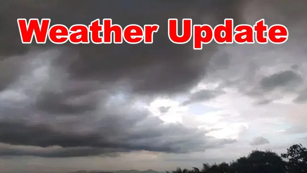
Rain likely in Telugu states, says weather department
The weather department said rain is likely in the Telugu states due to the southwest monsoon and a low pressure system. According to the Hyderabad Meteorological Centre, light to moderate rain or thundershowers are likely at isolated places in Telangana on July 8, 9 and 10. Strong surface winds of 50-60 kmph are likely over the three days. In Andhra Pradesh, officials warned of rain with thunder, lightning and gusty winds for five days.
Source
Mulugu — వాతావరణం · read the original report ↗
Desk check · compared with the source
What the desk checked (5)
- Light to moderate rain or thundershowers likely at isolated places in Telangana on 8, 9 and 10 July 2026 — Attributed in source to the IMD Hyderabad three-day forecast; dates appear as given in source text.
- Strong surface winds of 50-60 kmph likely in Telangana over the next three days — Figure appears in source as an official weather warning; no independent verification possible.
- Well-marked low pressure area lay over northwest Madhya Pradesh and adjoining southwest Uttar Pradesh at 08:30 hrs on 8 July 2026, with cyclonic circulation extending to 9.6 km — Technical details attributed to the Hyderabad Meteorological Centre bulletin.
- Northern Limit of Monsoon passes through 24.5°N/65°E, Barmer, Jodhpur, Rajgarh (Churu district), Bathinda, 32.5°N/70°E — Coordinates and locations reproduced from the met department bulletin.
- Rain with thunder, lightning and gusty winds likely in Andhra Pradesh for five days — Attributed to unnamed weather department officials; no individual named.
Analysts’ view opinion
A routine monsoon bulletin is never purely meteorological in the Telugu states, because rainfall performance quietly sets the political weather for both governments. The story describes a patchy, teasing monsoon — clouds that promise heavy rain but deliver light showers — with only light-to-moderate rain and 50-60 kmph winds forecast for Telangana over three days, and thunderstorms with gusty winds in Andhra Pradesh for five days. For the administrations in Amaravati and Hyderabad, that is an uncomfortable middle zone: not the deluge that triggers disaster-management scrutiny, but not the steady soaking that keeps farmers and irrigation politics calm either.
- Both state governments gain politically from visible preparedness messaging on squally winds and thunderstorms, since cheap, early advisories cost little and insure against blame if damage occurs.
- The bigger political risk in this forecast is agrarian rather than urban: an erratic monsoon feeds opposition narratives on sowing delays, input costs and farm relief, though the story itself reports no crop impact.
- The note that the low-pressure system has moved far from Telangana removes the state's excuse for any rain shortfall being an act of an unusual system, shifting attention to its own water and power management.
- Andhra Pradesh's longer five-day warning window means a longer period of political exposure for district administrations and ministers expected to be seen on the ground.
- Weather bulletins like this typically become contested only retrospectively — if damage follows, the argument turns to whether warnings were acted upon rather than whether they were issued.
What to watch — Watch whether either government converts these advisories into visible action — district alerts, farm advisories, ministerial reviews — and whether opposition parties begin framing the patchy rainfall as a governance and crop-relief issue.
This story is a weather forecast only: it establishes no rainfall deficit, crop damage, casualties, relief measures or political statement by any leader or party, and any political consequence is inference rather than reported fact.
Deep dive
Research brief · 8 facts · 5 dates · exam-readyThe brief
Context
The southwest monsoon is advancing across India and a well-marked low pressure area over central India has shaped weather over the Telugu states. Despite heavy cloud cover, the two states have seen only brief drizzles before the clouds disperse. The Hyderabad Meteorological Centre has now issued a forecast and warnings for Telangana for July 8-10, 2026, while officials have forecast thundery rain in Andhra Pradesh for five days.
Key facts
- The Northern Limit of Monsoon passes through 24.5°N/65°E, Barmer, Jodhpur, Rajgarh (Churu district), Bathinda and 32.5°N/70°E, as per the Hyderabad Meteorological Centre.
- Conditions are favourable for the southwest monsoon to advance over the remaining parts of the north Arabian Sea, Rajasthan, Haryana and Punjab, and the whole country, in the next 2-3 days.
- The well-marked low pressure area that lay over east Madhya Pradesh and neighbourhood a day earlier was over northwest Madhya Pradesh and adjoining southwest Uttar Pradesh at 08:30 hrs on 8 July 2026.
- The associated cyclonic circulation extends up to 9.6 km above sea level and tilts southwards with height.
- The system is likely to move north-northwestwards for some time and then recurve northeastwards; being far from Telangana, it will no longer influence the state's weather.
- Light to moderate rain or thundershowers are likely at isolated places in Telangana on 08-07-2026, 09-07-2026 and 10-07-2026.
- Strong surface winds of 50-60 kmph are likely over Telangana during the next three days.
- In Andhra Pradesh, rain with thunder, lightning and gusty winds is likely for the next five days due to southwesterly winds.
Timeline
- 7 July 2026 (a day earlier)Well-marked low pressure area lay over east Madhya Pradesh and adjoining areas.
- 8 July 2026, 08:30 hrsThe system moved over northwest Madhya Pradesh and adjoining southwest Uttar Pradesh; forecast of isolated light to moderate rain/thundershowers in Telangana issued.
- 9 and 10 July 2026Light to moderate rain or thundershowers likely at isolated places in Telangana; strong surface winds of 50-60 kmph likely through the three days.
- Next 2-3 days from 8 July 2026Conditions favourable for monsoon to cover the north Arabian Sea, remaining Rajasthan, Haryana, Punjab and the entire country.
- Next five days from 8 July 2026Rain with thunder, lightning and gusty winds forecast for Andhra Pradesh.
Who has a stake
- Hyderabad Meteorological Centre / weather department — Issues the monsoon position, forecast and three-day warnings for Telangana and the Andhra Pradesh outlook.
- Telangana residents — Face isolated light to moderate rain or thundershowers and strong surface winds of 50-60 kmph for three days.
- Andhra Pradesh residents — Warned of rain with thunder, lightning and gusty winds over the next five days.
- Farmers in the Telugu states — Sowing and field operations depend on rain that so far has been only brief drizzles despite heavy cloud cover.
- States along the monsoon's northern limit (Rajasthan, Haryana, Punjab) — Expected to be covered as the monsoon advances in the next 2-3 days.
Why it matters
Monsoon rain timing decides kharif sowing, reservoir inflows and urban preparedness across Telangana and Andhra Pradesh, so an accurate read on whether clouds will deliver matters directly to livelihoods. The warning of 50-60 kmph surface winds and of thunder and lightning in Andhra Pradesh also carries safety risks for people outdoors, power lines and standing crops.
UPSC angle
Prelims pointers
- Northern Limit of Monsoon (NLM) marks the northernmost boundary reached by the advancing southwest monsoon; on 8 July 2026 it passed through Barmer, Jodhpur, Rajgarh (Churu) and Bathinda.
- A 'well-marked low pressure area' is a stage in the intensification scale of low pressure systems used by the India Meteorological Department.
- The cyclonic circulation associated with the 8 July 2026 system extended to 9.6 km above sea level and tilted southwards with height.
- Hyderabad Meteorological Centre issues Telangana forecasts and warnings, including strong surface wind alerts of 50-60 kmph.
- Southwest monsoon was expected to cover the entire country within 2-3 days from 8 July 2026.
Mains framing
The forecast illustrates how synoptic systems, not just the monsoon's arrival date, determine actual rainfall over a region: although heavy clouds built up over the Telugu states, only drizzles followed, and the well-marked low pressure area that could have delivered widespread rain drifted to northwest Madhya Pradesh and southwest Uttar Pradesh, leaving Telangana outside its influence. What remains is the broad southwesterly flow, which the Hyderabad Meteorological Centre expects to yield only isolated light to moderate rain or thundershowers on 8, 9 and 10 July 2026, alongside strong surface winds of 50-60 kmph, while Andhra Pradesh is warned of thunder, lightning and gusty winds for five days. The implications are two-fold: rainfall deficits in the sowing window despite an advancing monsoon, and localised hazards from wind and lightning rather than from sustained rain. The way forward lies in acting on the district-level forecasts and warnings issued by the meteorological centre, timing agricultural operations to short rain spells, and taking lightning and wind safety precautions during the warned period; the source does not describe any further policy measures.
Key terms
- Southwest monsoon
- The seasonal rain-bearing wind system whose advance over Rajasthan, Haryana, Punjab and the rest of the country was expected within 2-3 days of 8 July 2026.
- Northern Limit of Monsoon (NLM)
- The line marking how far north the monsoon has advanced; on 8 July 2026 it ran through Barmer, Jodhpur, Rajgarh (Churu district) and Bathinda.
- Well-marked low pressure area
- An intensified low pressure system; on 8 July 2026 it lay over northwest Madhya Pradesh and adjoining southwest Uttar Pradesh.
- Cyclonic circulation
- A rotating wind system in the atmosphere; the one linked to this low extended to 9.6 km height and tilted southwards with altitude.
- Strong surface winds
- Near-ground winds; 50-60 kmph winds were warned for Telangana over three days from 8 July 2026.
- Hyderabad Meteorological Centre
- The regional weather office issuing forecasts and warnings for Telangana referenced in this bulletin.
Practice questions
- Explain the concept of the Northern Limit of Monsoon and how its position is used to track the advance of the southwest monsoon over India.
- How do low pressure areas and cyclonic circulations modulate rainfall distribution within a monsoon season? Illustrate with the July 2026 situation over the Telugu states.
- Discuss the significance of short-range weather warnings, such as alerts for 50-60 kmph surface winds and lightning, for agriculture and disaster preparedness in Telangana and Andhra Pradesh.
Grounded only in the source report — figures and dates are the source's, not inferred.