
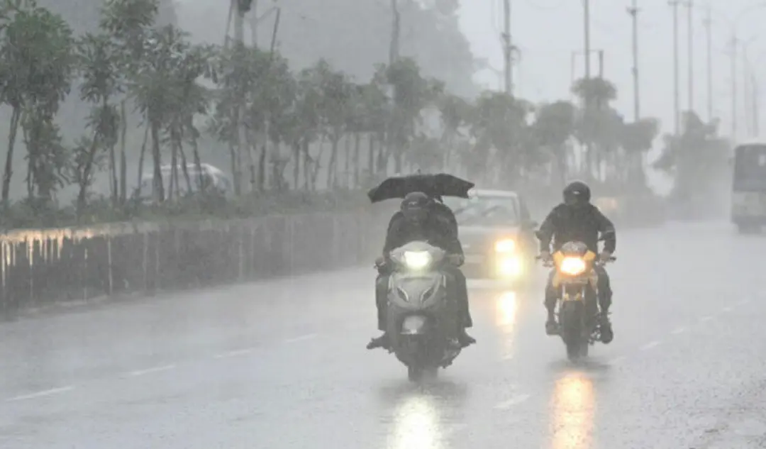
Heavy rains hit erstwhile Adilabad; shepherd washed away in stream
Parts of the erstwhile Adilabad district received moderate to heavy rains in the last 24 hours, affecting normal life. A shepherd was swept away in a flooded stream at Etyala village in Dahegaon mandal of Kumuram Bheem Asifabad district. According to the Telangana Development Planning Society, Khanapur mandal recorded the highest rainfall at 111.7 mm, followed by Laxmanachanda at 111.6 mm. Nirmal district logged 464 mm against a normal 351 mm from June 1 to July 19, an excess of 32 per cent. Swollen streams hit connectivity to remote villages.
Source
Kumuram Bheem Asifabad — jobs · read the original report ↗
Desk check · compared with the source
What the desk checked (5)
- A shepherd was washed away in a flooded stream at Etyala village, Dahegaon mandal, Kumuram Bheem Asifabad district. — Stated twice in the source but with no named official source or police attribution.
- Khanapur mandal recorded the highest rainfall at 111.7 mm, followed by Laxmanachanda at 111.6 mm. — Figures appear in source, attributed to the Telangana Development Planning Society.
- Nirmal district's actual rainfall was 464 mm against a normal 351 mm from June 1 to July 19, an excess of 32 per cent. — Figures appear in source and are internally consistent with the stated excess.
- Kumuram Bheem Asifabad recorded 507 mm against normal 395 mm (28% excess); Adilabad 494 mm against 398 mm (24% excess); Mancherial 416 mm against 364 mm. — Figures appear in source, attributed to the same agency; percentages roughly match the stated totals.
- Swollen streams and rivulets disrupted connectivity to many remote villages. — General claim in source; no village names or official count given.
Analysts’ view opinion
On the surface this is a weather bulletin, but rainfall running 24 to 32 per cent above normal across erstwhile Adilabad, swollen streams and cut-off villages are politically combustible material. In tribal and agency mandals of Asifabad and Adilabad, remote villages losing connectivity immediately raises questions about roads, bridges and causeways — a test for whoever holds office and an opening for the opposition. The shepherd swept away adds a human dimension that can quickly pull pastoral communities' welfare and compensation into the political conversation.
- Public judgement in flood events usually rests on the speed of relief and compensation announcements; delay converts a natural event into a political liability.
- Remote villages being cut off exposes long-pending infrastructure gaps, and both sides are likely to argue over which government owns that backlog.
- Handling of relief in tribal-dominated constituencies is a direct credibility test for local MLAs and district-level leadership.
- The shepherd incident could revive demands around safety, insurance and compensation for pastoral communities, which carry meaningful electoral weight in this belt.
- The story records no statement, visit or official response from any leader or party, so it does not show the political reaction having begun publicly.
What to watch — Watch how quickly ministers and MLAs tour the affected mandals and announce relief, and whether the opposition frames the connectivity breakdown as an infrastructure failure.
The story establishes only rainfall figures, one person washed away and disrupted connectivity; it does not establish any government or party response, compensation, accountability, or the confirmed fate of the shepherd.
Deep dive
Research brief · 8 facts · 5 dates · exam-readyThe brief
Context
Erstwhile Adilabad district in northern Telangana — now split into Adilabad, Nirmal, Kumuram Bheem Asifabad and Mancherial districts — received moderate to heavy rainfall in the 24 hours before 21 July 2024, disrupting normal life. A shepherd was washed away in a flooded stream at Etyala village in Dahegaon mandal of Kumuram Bheem Asifabad district. Rainfall data compiled by the Telangana Development Planning Society showed all four districts recording surplus rainfall against normal for the June 1–July 19 period. Swollen streams and rivulets cut off connectivity to many remote villages.
Key facts
- Khanapur mandal recorded the highest rainfall at 111.7 mm, followed by Laxmanachanda mandal at 111.6 mm.
- Nirmal district's average rainfall was 69 mm; actual seasonal rainfall 464 mm against a normal of 351 mm from June 1 to July 19 — an excess of 32 per cent.
- Kumuram Bheem Asifabad district averaged 60 mm, with Lingapur mandal highest at 93.6 mm; actual 507 mm against normal 395 mm, an excess of 28 per cent.
- In Kumuram Bheem Asifabad, Jainoor, Sirpur (U), Wankidi, Asifabad, Chintalamanepalli and Penchikalpet mandals recorded between 60 and 82 mm.
- Adilabad district averaged 56 mm, with Indervelli mandal highest at 91.3 mm; actual 494 mm against normal 398 mm, an excess of 24 per cent.
- Mancherial district recorded actual rainfall of 416 mm against a normal of 364 mm till Saturday, with an average rainfall of 55.4 mm.
- A shepherd was swept away in a flooding stream while attending nature's call at Etyala village, Dahegaon mandal, Kumuram Bheem Asifabad district.
- Streams and rivulets swelled, hitting connectivity of many remote villages in the erstwhile district.
Timeline
- June 1, 2024Start of the monsoon rainfall accounting period used for the district surplus/deficit comparisons.
- Up to July 19, 2024Nirmal logs 464 mm against normal 351 mm; Kumuram Bheem Asifabad 507 mm against 395 mm; Adilabad 494 mm against 398 mm.
- Saturday (July 20, 2024)Mancherial district's actual rainfall measured at 416 mm against normal 364 mm.
- 24 hours before July 21, 2024Moderate to heavy rains lash parts of erstwhile Adilabad district; Khanapur records 111.7 mm; shepherd washed away at Etyala village.
- July 21, 2024, 12:18 PMReport published on the rainfall and the shepherd being swept away.
Who has a stake
- Residents of remote villages in erstwhile Adilabad district — Connectivity cut off as streams and rivulets swelled, disrupting normal life and access.
- The shepherd of Etyala village, Dahegaon mandal — Washed away in a flooded stream — the human cost of the rainfall event.
- Telangana Development Planning Society (TDPS) — State agency whose mandal-wise rainfall measurements form the basis of the rainfall assessment.
- District administrations of Adilabad, Nirmal, Kumuram Bheem Asifabad and Mancherial — Responsible for relief, rescue and restoring road links to marooned villages.
- India Meteorological Department (IMD) — Forecast heavy to very heavy rains over Telangana for the next 24 hours, guiding public warnings.
Why it matters
Surplus monsoon rainfall of 24 to 32 per cent above normal across four districts of erstwhile Adilabad shows how quickly heavy spells translate into flooded streams, snapped connectivity and loss of life in remote, tribal-belt villages. The death of a shepherd in a flooded stream underlines that casualties in such events often occur in ordinary, everyday movement rather than in large-scale flooding. Accurate mandal-level rainfall monitoring and early warning are therefore central to district-level disaster preparedness.
UPSC angle
Prelims pointers
- Telangana Development Planning Society (TDPS) compiles mandal-wise rainfall data in Telangana.
- Khanapur mandal recorded the highest rainfall at 111.7 mm; Laxmanachanda 111.6 mm (24 hours to 21 July 2024).
- Rainfall excess June 1–July 19, 2024: Nirmal 32%, Kumuram Bheem Asifabad 28%, Adilabad 24%.
- Erstwhile Adilabad district now comprises Adilabad, Nirmal, Kumuram Bheem Asifabad and Mancherial districts.
- Kumuram Bheem Asifabad recorded the highest actual rainfall among the four districts at 507 mm (normal 395 mm).
- IMD had forecast heavy to very heavy rains over Telangana for the next 24 hours.
Mains framing
Heavy monsoon spells in the erstwhile Adilabad region illustrate the gap between rainfall surplus as a statistic and vulnerability on the ground. Mandal-level figures show extreme localised intensity — 111.7 mm in Khanapur and 111.6 mm in Laxmanachanda in 24 hours — even as seasonal totals stood 24 to 32 per cent above normal across Adilabad, Nirmal, Kumuram Bheem Asifabad and Mancherial. Because much of this terrain is remote and dependent on roads crossing unbridged streams and rivulets, a single intense spell swells watercourses, severs village connectivity and exposes people to drowning risk, as in the death of a shepherd at Etyala village in Dahegaon mandal. The implications are twofold: relief and health access to interior habitations becomes difficult precisely when needed, and casualty risk concentrates among those whose livelihoods, such as herding, keep them near water bodies. The way forward suggested by the source is stronger reliance on mandal-wise rainfall monitoring by agencies like the Telangana Development Planning Society and timely IMD warnings, translated into local-level advisories, stream crossing restrictions and readiness to restore connectivity to cut-off villages.
Key terms
- Telangana Development Planning Society (TDPS)
- State body cited as the source of average and mandal-wise rainfall measurements for Telangana districts.
- Erstwhile Adilabad district
- The pre-reorganisation district now covering Adilabad, Nirmal, Kumuram Bheem Asifabad and Mancherial districts.
- Mandal
- Administrative sub-district unit in Telangana at which rainfall is recorded, for example Khanapur, Laxmanachanda, Lingapur, Indervelli.
- Normal rainfall
- The long-term expected rainfall for a period, against which actual rainfall is compared to compute excess or deficit.
- IMD
- India Meteorological Department, which had forecast heavy to very heavy rains over Telangana for the next 24 hours.
Practice questions
- Discuss how localised high-intensity rainfall, rather than seasonal totals alone, drives disaster risk in remote districts, using the erstwhile Adilabad case.
- Examine the role of state-level agencies such as the Telangana Development Planning Society and the IMD in translating rainfall data into district disaster preparedness.
- How does poor connectivity across streams and rivulets aggravate monsoon vulnerability in tribal and interior habitations? Suggest measures.
Grounded only in the source report — figures and dates are the source's, not inferred.