
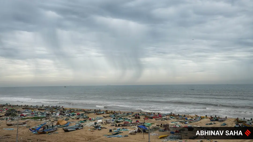
Deep depression crosses coast near Kalingapatnam; Puri bans sea bathing
The deep depression over the north Andhra Pradesh coast crossed the coast southwest of Kalingapatnam in Srikakulam district between 11 pm on September 23 and 1 am on September 24, the IMD said. Winds reached up to 75 km per hour. The system is expected to move northwestwards and weaken gradually. Odisha issued a heavy rain alert for Puri for two days, where red flags were hoisted and tourists barred from sea bathing. Vijayawada schools shut for a second day.
Source
Indian Express — India · read the original report ↗
Desk check · compared with the source
What the desk checked (5)
- Deep depression crossed the coast southwest of Kalingapatnam between 11 pm on September 23 and 1 am on September 24. — Directly attributed to an IMD statement quoted in the source, including an IMD social media post.
- Rainfall was accompanied by maximum sustained winds of up to 75 km per hour. — Figure appears in source; attributed to the met department context, no separate sourcing line.
- At 5:30 am Thursday the system lay about 50 km west of Kalingapatnam, 80 km north-northeast of Visakhapatnam and 170 km southwest of Gopalpur. — Distances appear in source as IMD tracking details; internally consistent with landfall location.
- Puri administration hoisted red flags, banned tourists from sea bathing and deployed lifeguards. — Attributed to Puri administration; no named official quoted.
- Schools in Vijayawada declared a holiday for a second day; Jharkhand issued an orange alert for Ranchi and West Singhbhum. — Stated in source without named authority; consistent with the weather system described.
Analysts’ view opinion
This is a weather story at heart, but disaster management on the Andhra–Odisha coast is always a political test. The IMD's assessment that the deep depression will weaken after crossing near Kalingapatnam gives governments breathing room, yet the flooding in low-lying Vijayawada and a second straight day of school closures keep administrative competence in the frame. Puri's red flags, bathing ban and deployed lifeguards reflect the now-standard political logic of being visibly pre-emptive before any loss of life occurs.
- A weakening system lowers immediate political pressure, but the relief is provisional until damage assessments come in.
- Inundation of low-lying areas in Vijayawada is the classic opening for opposition criticism of drainage and urban infrastructure — though no such reaction is recorded in this story.
- Declaring school holidays is a low-cost, high-visibility decision; erring on the side of caution is far more forgivable politically than being caught unprepared.
- Puri's bathing ban trades short-term tourism activity for safety, a calculation that avoids the far heavier cost of a preventable tragedy.
- Simultaneous alerts across Andhra, Odisha and Jharkhand raise the familiar questions of inter-state and Centre–state coordination and relief funding.
What to watch — Watch for the first credible damage, crop and casualty assessments once the system weakens, along with chief ministerial field visits and any relief package or demand for central assistance.
The story establishes nothing about the scale of damage, casualties, statements by political leaders or opposition criticism — it carries only meteorological and administrative detail.
Deep dive
Research brief · 8 facts · 7 dates · exam-readyThe brief
Context
A deep depression — a low-pressure system one stage below a cyclonic storm on the IMD's scale — formed over the north Andhra Pradesh coast and brought days of heavy rain before crossing the coast near Kalingapatnam in Srikakulam district. The India Meteorological Department (IMD) tracked it moving west-northwestwards at just 3 km per hour, with maximum sustained winds up to 75 km per hour. Its landfall and inland track triggered rain alerts across Andhra Pradesh, Odisha and Jharkhand, with Puri banning sea bathing and Vijayawada schools shutting for a second day. The IMD expects the system to weaken progressively into a well-marked low pressure area.
Key facts
- The deep depression crossed the coast close to southwest of Kalingapatnam, Srikakulam district, between 11 pm on September 23 and 1 am on September 24, per the IMD.
- The system moved west-northwestwards at a speed of 3 km per hour during the preceding six hours.
- Rainfall was accompanied by maximum sustained winds of up to 75 km per hour.
- At 5:30 am on Thursday the system lay centred over north coastal Andhra Pradesh, about 50 km west of Kalingapatnam, 80 km north-northeast of Visakhapatnam and 170 km southwest of Gopalpur (Odisha).
- IMD forecast: the system would move northwestwards maintaining deep depression intensity for 12 hours, then move north-northwestwards and weaken gradually over the subsequent 24 hours.
- The regional weather department said it would weaken into a depression on Thursday, remain so till Friday, and weaken into a well-marked low pressure area on Saturday.
- Odisha issued a heavy rain alert for Puri for two days; the Puri administration hoisted red flags, banned tourists from sea bathing and deployed lifeguards along beach sectors.
- Vijayawada in NTR district saw continuous rain since Wednesday morning, inundating low-lying areas; several schools declared a holiday for a second day.
Timeline
- Wednesday morning (September 23)Continuous rainfall begins in Vijayawada, NTR district; low-lying areas inundated.
- 11 pm September 23 to 1 am September 24Deep depression crosses the coast close to southwest of Kalingapatnam, Srikakulam district.
- 5:30 am, Thursday September 24System lies centred over north coastal Andhra Pradesh, 50 km west of Kalingapatnam.
- Thursday September 24IMD statement issued; schools in Vijayawada shut for a second day; Puri hoists red flags and bans sea bathing; system to weaken into a depression.
- Till 8.30 am FridayJharkhand 'orange' alert for heavy to very heavy rain in Ranchi, West Singhbhum and other areas.
- FridaySystem expected to remain a depression.
- SaturdaySystem expected to weaken into a well-marked low pressure area.
Who has a stake
- India Meteorological Department (IMD) — Tracking and forecasting the system's movement and intensity, issuing statements and alerts that drive state responses.
- Andhra Pradesh (Srikakulam, Visakhapatnam, NTR districts) — Landfall zone and heavy rain area; inundation in Vijayawada's low-lying areas and school closures.
- Odisha and the Puri administration — Two-day heavy rain alert; responsible for tourist safety through red flags, sea-bathing ban and lifeguard deployment.
- Tourists at Puri beach — Barred from bathing in the sea during rough conditions.
- School students and parents in Vijayawada — Second consecutive day of school holidays due to continuous rainfall.
- Jharkhand (Ranchi, West Singhbhum) — Under 'orange' alert for heavy to very heavy rainfall as the system moves inland.
Why it matters
Deep depressions crossing the east coast are a recurring monsoon hazard that flood coastal Andhra Pradesh and Odisha and carry heavy rain deep inland into Jharkhand. Accurate IMD tracking of landfall timing and weakening allows district administrations to act in advance — closing schools, restricting beach access and deploying lifeguards — which is the difference between disruption and disaster.
UPSC angle
Prelims pointers
- Deep depression crossed coast southwest of Kalingapatnam, Srikakulam district (Andhra Pradesh), between 11 pm Sept 23 and 1 am Sept 24.
- Maximum sustained wind speed recorded: up to 75 km per hour; system moved at 3 km per hour.
- IMD weakening sequence: deep depression to depression to well-marked low pressure area.
- Gopalpur is in Odisha; the system lay 170 km southwest of it at 5:30 am Thursday.
- Puri used red flags plus lifeguard deployment and a sea-bathing ban as its tourist-safety measure.
- IMD colour code: 'orange' alert issued by Jharkhand for heavy to very heavy rainfall in Ranchi and West Singhbhum.
Mains framing
The episode illustrates how a single low-pressure system over the Bay of Bengal can cascade into a multi-state governance challenge. A slow-moving deep depression — travelling at just 3 km per hour with winds up to 75 km per hour — crossed the Andhra coast near Kalingapatnam and, because slow movement means prolonged rainfall over the same area, left Vijayawada's low-lying localities inundated and forced a second day of school closures. As the system tracked northwestwards, the risk migrated: Odisha placed Puri under a two-day heavy rain alert with red flags, a sea-bathing ban and lifeguards, while Jharkhand issued an 'orange' alert for Ranchi and West Singhbhum. The response shows the value of IMD's graded intensity forecasts — deep depression weakening to depression, then to a well-marked low pressure area — in letting district administrations calibrate action to expected severity. The way forward lies in strengthening this last-mile translation of forecasts into local action: urban drainage in cities like Vijayawada that flood on a day of continuous rain, tourist-safety protocols at beaches, and inland preparedness for systems that retain rain-bearing strength long after landfall.
Key terms
- Deep depression
- An IMD classification for a low-pressure system whose intensity lies above a depression and below a cyclonic storm; this one had winds up to 75 kmph.
- Well-marked low pressure area
- The weakest stage in the sequence cited by IMD, into which the system was expected to decay by Saturday.
- India Meteorological Department (IMD)
- The national weather agency that tracked the system's landfall, position and forecast weakening, and issues rainfall alerts.
- Orange alert
- A warning level used for heavy to very heavy rainfall; issued by Jharkhand for Ranchi and West Singhbhum for 24 hours till 8.30 am Friday.
- Red flags at Puri
- Visual warning hoisted on the beach by the Puri administration to signal unsafe sea conditions, alongside a ban on tourists bathing.
- Kalingapatnam
- Coastal location in Srikakulam district, Andhra Pradesh, near which the deep depression crossed the coast.
Practice questions
- Explain the IMD's classification of low-pressure systems and discuss why a slow-moving deep depression can cause more rainfall damage than a faster-moving, more intense system.
- Examine how weather warnings are translated into administrative action at the district level, using the responses in Puri, Vijayawada and Jharkhand as illustrations.
- Coastal Andhra Pradesh and Odisha face repeated monsoon-season landfalls. Suggest measures to reduce urban inundation and protect tourists during such events.
Grounded only in the source report — figures and dates are the source's, not inferred.