
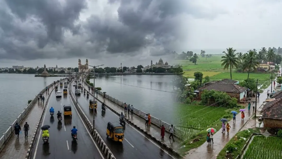
Light to moderate rain likely in both Telugu states in 24 hours
The meteorological centre said a surface circulation and trough over the Bay of Bengal would bring light to moderate rain in many parts of both Telugu states over the next 24 hours. Thunderstorms are likely in Srikakulam, Visakhapatnam, Anakapalli, Adilabad and Mulugu districts. Fishermen were advised to stay alert as coastal winds of 30-40 kmph are expected. Hyderabad may record 31-33 degrees Celsius maximum and 22-24 minimum, with showers in Kukatpally, Madhapur and Gachibowli.
Source
ఆంధ్రప్రదేశ్ వార్తలు — Andhra Pradesh · read the original report ↗
Desk check · compared with the source
What the desk checked (5)
- A surface circulation and trough over the Bay of Bengal will bring light to moderate rain in many parts of both Telugu states in the next 24 hours. — Attributed in source to the meteorological centre; figure/timeframe appears in source.
- Thunderstorms and moderate showers are likely in north coastal AP districts including Srikakulam, Vizianagaram, Parvathipuram Manyam, Visakhapatnam and Anakapalli. — Appears in source as forecast detail; no named official quoted.
- Winds of 30-40 kmph are expected along the coast, with fishermen advised to stay alert. — Figure appears in source and is attributed generally to officials.
- Hyderabad maximum temperature 31-33C and minimum 22-24C, with light to moderate showers in Kukatpally, Madhapur, Gachibowli, Miyapur, Secunderabad and Alwal. — Figures appear in source; source of the city forecast not individually named.
- Disaster management officials advised people to avoid sheltering under trees or near electric poles and transformers during thunderstorms. — Attributed in source to disaster management authorities; no named official.
Analysts’ view opinion
This is a weather bulletin, but in both Telugu states rain warnings have a habit of becoming a test of administrative competence. Rain during the monsoon withdrawal phase touches three politically sensitive nerves at once — standing and harvest-ready crops, urban drainage, and fishermen's livelihoods — all things voters experience directly. For now the forecast is only light to moderate rain, so the political stakes are modest; what matters is the visible speed of the response.
- By issuing advance warnings and safety advisories, the disaster management machinery in both states gets an opportunity to be seen as pre-emptive rather than reactive.
- The forecast of showers over Kukatpally, Madhapur and Gachibowli means that if traffic snarls or waterlogging follow, criticism tends to land quickly on city administration in Hyderabad.
- The 30-40 kmph squally wind warning along Srikakulam, Visakhapatnam and Anakapalli affects fishing livelihoods, an area where local demands for relief and support often surface fast.
- If moderate rain in north and east Telangana districts such as Adilabad and Mulugu coincides with harvesting work, crop-loss and input-subsidy arguments become a natural line of attack for opposition parties.
- If the rain stays within the forecast range, this remains purely an administrative matter; the story records no political statement or reaction from any party.
What to watch — If rainfall exceeds the moderate range, watch how quickly both state governments move on urban waterlogging, crop-damage assessment and support for coastal fishermen.
The story establishes only a weather forecast — it does not establish any damage, political statement, government or opposition reaction, or policy decision.
Deep dive
Research brief · 8 facts · 3 dates · exam-readyThe brief
Context
The India Meteorological Department's regional meteorological centre has flagged a surface circulation and a trough over the Bay of Bengal, along with the ongoing withdrawal of the southwest monsoon, as drivers of light to moderate rain across Andhra Pradesh and Telangana over the next 24 hours. Coastal districts of north and south Andhra are under the influence of sea breeze, while north and east Telangana districts may see isolated moderate showers. Thunderstorm activity, gusty coastal winds and localised urban showers in Hyderabad have prompted advisories for fishermen, farmers and commuters.
Key facts
- The meteorological centre attributed the expected rain to a surface circulation and a trough persisting over the Bay of Bengal, plus the withdrawal of the monsoon.
- Light to moderate rain is forecast in many parts of both Telugu states over the next 24 hours, with thunder and lightning in some areas.
- Gusty winds of 30-40 kmph are expected along the coast; officials advised fishermen to stay alert.
- Cloudy skies all day with afternoon or evening thunderstorms are likely in Srikakulam, Vizianagaram, Parvathipuram Manyam, Visakhapatnam and Anakapalli districts.
- Isolated moderate rain is likely in Adilabad, Kumarambheem Asifabad, Mancherial, Jayashankar Bhupalpally, Mulugu and Bhadradri Kothagudem districts of Telangana.
- Hyderabad (GHMC area) may record a maximum temperature of 31-33 degrees Celsius and a minimum of 22-24 degrees Celsius.
- Light to moderate showers are expected in the evening or night in Kukatpally, Madhapur, Gachibowli, Miyapur, Secunderabad and Alwal.
- Rayalaseema districts Anantapur, Sri Sathya Sai, Kadapa and Kurnool are likely to see normal daytime temperatures with light evening rain at some places.
Timeline
- Next 24 hours (forecast period)Light to moderate rain likely in many parts of Andhra Pradesh and Telangana due to Bay of Bengal surface circulation and trough.
- Afternoon/evening of the forecast dayThunderstorms with lightning expected in north coastal Andhra districts; weather to cool in Godavari, Krishna and Guntur districts.
- Evening/night of the forecast dayLight to moderate showers in western and northern Hyderabad; traffic department advises commuters to plan journeys.
Who has a stake
- Fishermen along the Andhra Pradesh coast — Warned to stay alert as coastal gusty winds of 30-40 kmph are expected, affecting sea-going safety.
- Farmers and rural labourers — Weather described as favourable for farm work, but they are told to move to safe places or buildings during thunder and rain.
- Greater Hyderabad Municipal Corporation (GHMC) residents — Generally cloudy skies and evening showers in western and northern localities; low-lying area residents asked to stay alert.
- City traffic department — Advised motorists to plan travel keeping evening traffic disruptions from showers in mind.
- Disaster management authorities — Issued precautions against standing under trees or near electric poles and transformers during thunderstorms.
- Meteorological centre / weather experts — Responsible for issuing district-wise forecasts and warnings on the circulation, trough and monsoon withdrawal.
Why it matters
Rain during monsoon withdrawal shapes late-season farm operations, sea-going safety and urban traffic in two states where agriculture and a large metro both depend on accurate short-range warnings. Thunderstorm and lightning advisories matter directly for lives, since open-field workers and people sheltering near trees or transformers are the most exposed. District-level forecasts also test how well local disaster management machinery converts alerts into precautions.
UPSC angle
Prelims pointers
- A surface circulation and a trough over the Bay of Bengal were cited as the systems causing rain in both Telugu states.
- Monsoon withdrawal was also given as a reason for the expected rainfall.
- Coastal wind speed forecast: 30-40 kmph, triggering an alert for fishermen.
- Hyderabad forecast: maximum 31-33 degrees Celsius, minimum 22-24 degrees Celsius.
- Telangana districts named for moderate rain: Adilabad, Kumarambheem Asifabad, Mancherial, Jayashankar Bhupalpally, Mulugu, Bhadradri Kothagudem.
- Nizamabad, Kamareddy and Medak were forecast to have partly cloudy skies.
Mains framing
Short-range weather forecasting in peninsular India becomes critical during the monsoon withdrawal phase, when residual systems such as surface circulations and troughs over the Bay of Bengal continue to deliver light to moderate and sometimes thunderous rainfall. In this instance the meteorological centre issued a district-differentiated outlook: thunderstorms over north coastal Andhra Pradesh, isolated moderate rain over forested north and east Telangana districts, humid daytime conditions with evening cooling over Godavari-Krishna-Guntur and Nalgonda-Khammam belts, and localised evening showers over western and northern Hyderabad. The implications are three-fold: livelihood risk for fishermen facing 30-40 kmph coastal gusts, lightning and crop-timing risk for farmers and agricultural labour, and urban mobility and waterlogging risk for commuters and low-lying colonies in the GHMC area. The way forward, as reflected in the advisories themselves, lies in last-mile dissemination of localised warnings, disaster management guidance on avoiding trees, electric poles and transformers during lightning, traffic planning ahead of evening showers, and continuous public attention to local weather bulletins rather than generalised state-level forecasts.
Key terms
- Surface circulation
- A low-level cyclonic wind pattern near the surface, here over the Bay of Bengal, that draws in moisture and triggers rainfall.
- Trough
- An elongated zone of relatively low pressure that favours cloud formation and rain along its axis.
- Monsoon withdrawal (rutupavanala tirogamanam)
- The retreating phase of the southwest monsoon, cited in the source as an additional reason for the expected rain.
- GHMC
- Greater Hyderabad Municipal Corporation, the civic body whose area the Hyderabad city forecast covers.
- Meteorological centre
- The regional weather office that issued the 24-hour forecast, thunderstorm warnings and fishermen's advisory for the two states.
- Disaster management authority
- The agency that issued safety precautions for thunderstorms, including avoiding trees, electric poles and transformers.
Practice questions
- How do post-monsoon Bay of Bengal systems such as surface circulations and troughs influence rainfall distribution over Andhra Pradesh and Telangana? Discuss with reference to recent forecasts.
- Evaluate the effectiveness of district-level weather warnings in protecting fishermen, farmers and urban commuters. What gaps remain in last-mile dissemination?
- Lightning is a major cause of weather-related deaths in India. Suggest measures to reduce casualties among open-field workers during thunderstorm events.
Grounded only in the source report — figures and dates are the source's, not inferred.