
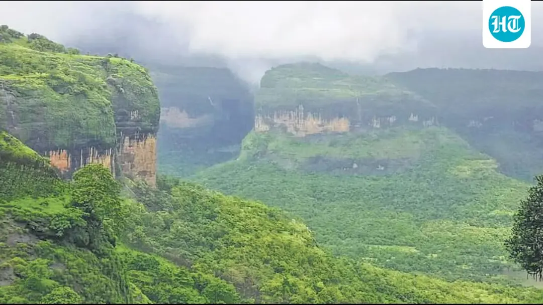
Karnataka Assembly seeks ground survey on Western Ghats eco-zone
The Karnataka Assembly on Tuesday unanimously adopted a resolution seeking a review of the Kasturirangan report on ecologically sensitive areas in the Western Ghats and one year for a physical survey before the final notification. The July draft proposes declaring 20,668 sq km in the state an Ecologically Sensitive Area, covering 1,449 villages across 10 districts. The state says farms, plantations and homes could be included. Environmentalists say restrictions would mainly target mining and polluting industries.
Source
Hindustan Times — India · read the original report ↗
Desk check · compared with the source
What the desk checked (5)
- Karnataka Assembly unanimously adopted a resolution on Tuesday seeking review of the Kasturirangan report and one year for a physical survey. — Attributed in source to the Assembly proceedings; figure of one year appears in source.
- The latest July draft notification proposes 20,668 sq km of Karnataka's Western Ghats as an ESA, covering 1,449 villages in 10 districts. — Figures appear in source; drawn from the draft notification, not independently verified.
- The 2013 Kasturirangan report proposed an ESA over about 37% of the Western Ghats, or 59,940 sq km across six states. — Figures appear in source and are internally consistent with the Karnataka share cited.
- Chief Minister DK Shivakumar said the state is seeking a scientific revision, not disrespecting the recommendations. — Direct quote attributed to the named chief minister in the source.
- Environmentalist Akhilesh Chipli said restrictions would mainly target mining and highly polluting industries. — Attributed to a named individual; opinion, not a verified fact.
Analysts’ view opinion
A unanimous resolution is the tell here: on the Western Ghats, Karnataka's parties have decided there is no electoral upside in being seen to defend a Delhi-drawn map against farmers and plantation owners in ten districts. By framing its demand as a year-long ground survey rather than outright rejection, the state government keeps the conservation high ground while shifting the political cost of any restrictions onto the Centre. The ask for central funds and alternative livelihoods is the classic next move — it converts an ecological dispute into a Centre-state bargaining question.
- Unanimity across party lines shows that 1,449 villages across 10 districts is a constituency no side wants to antagonise, which effectively takes the issue out of routine partisan combat within the state.
- The framing chosen by Chief Minister DK Shivakumar — scientific revision rather than rejection — is politically efficient, allowing the state to court both agrarian voters and conservation-minded urban opinion.
- The proposed retired-judge committee with farmers, industry, scientists and gram panchayat inputs spreads ownership of any eventual boundary decision and insulates the government from blame.
- History favours delay as a strategy: six earlier drafts lapsed amid state objections, and a draft's 725-day life gives states a built-in incentive to keep negotiating rather than settle.
- Because Kerala and Maharashtra have also opposed the notifications, the Centre faces a multi-state front rather than a single dissenting government, which raises the political cost of pushing the current draft through.
What to watch — Watch whether the Union environment ministry grants the one-year window or lets the current draft run its course, and whether Karnataka's committee is actually constituted with the promised farmer, industry and panchayat representation.
The story does not establish how much of the 20,668 sq km is already notified forest versus farmland and settlements — the core factual dispute between the state and environmentalists remains unresolved — nor does it record the Centre's response to the resolution.
Deep dive
Research brief · 8 facts · 8 dates · exam-readyThe brief
Context
The Western Ghats, a 1,600-km mountain range along India's west coast and a UNESCO World Heritage Site since 2012, has been the subject of over a decade of dispute over how much of it should be declared an Ecologically Sensitive Area (ESA). After the 2011 Madhav Gadgil panel report was opposed by states, the Centre set up a high-level working group under former ISRO chairperson K Kasturirangan, whose 2013 report proposed an ESA over about 37% of the Ghats. Seven draft notifications have since been issued, with six lapsing amid state objections. On Tuesday the Karnataka Assembly unanimously adopted a resolution seeking a review of the Kasturirangan report and one year for a physical ground survey before the final notification.
Key facts
- The July draft notification proposes declaring 20,668 sq km of Karnataka's Western Ghats an ESA, covering 1,449 villages across 10 districts.
- The Kasturirangan group's 2013 report proposed an ESA over about 37% of the Western Ghats — 59,940 sq km across six states.
- Seven draft ESA notifications have been issued; the first was on March 10, 2014, and a draft lapses 725 days after issue.
- The Western Ghats stretch 1,600 km across Gujarat, Maharashtra, Goa, Karnataka, Tamil Nadu and Kerala.
- The range hosts at least 325 globally threatened species and was declared a UNESCO World Heritage Site in 2012.
- Karnataka objects to a provision under which an entire village could be included in the ESA if one-fifth of its area falls under forest limits.
- Proposed ESA restrictions include bans on mining and sand extraction, red category (most polluting) industries, thermal power plants and limits on large construction and major development projects.
- Since 2022, an expert committee constituted by the Union environment ministry has been examining states' suggestions before finalising the notification.
Timeline
- 2010Centre appoints an expert panel under ecologist Madhav Gadgil to strengthen protection of the Western Ghats; it proposes graded protection with local community participation.
- 2012Western Ghats declared a UNESCO World Heritage Site.
- 2013K Kasturirangan-headed high-level working group report proposes an ESA of 59,940 sq km (about 37% of the Ghats), including 20,668 sq km in Karnataka.
- March 10, 2014First draft ESA notification issued; six drafts before the latest lapsed as states differed on area and restrictions.
- Since 2022An environment ministry expert committee begins examining state suggestions ahead of finalisation.
- July (latest draft)Seventh draft notification issued, proposing 20,668 sq km ESA in Karnataka across 1,449 villages in 10 districts.
- TuesdayKarnataka Assembly unanimously adopts a resolution seeking review of the Kasturirangan report and one year for a physical survey.
- WednesdayCM DK Shivakumar says the state is not disrespecting the Kasturirangan recommendations but wants them scientifically revised.
Who has a stake
- Karnataka government and Assembly — Wants ESA limited to notified and actually forested land, a joint physical survey, and one year before final notification.
- Union environment ministry — Issues draft notifications, collects objections, forwards them to states, and must finalise the ESA through its expert committee.
- Residents of the 1,449 villages in 10 districts — Fear farms, plantations, houses and public amenities falling inside the ESA, affecting construction, property division and inheritance.
- Environmentalists (e.g. Akhilesh Chipli of Sagara) — Argue most of the 20,668 sq km is already notified forest and restrictions target mining and polluting industries, not residents.
- Other Western Ghats states such as Kerala and Maharashtra — Have also opposed the draft notifications over demarcated area and development restrictions.
- Mining, quarrying and red category industries — Face bans or curbs on operations within the notified ESA.
Why it matters
The Western Ghats, home to at least 325 globally threatened species, cannot be conserved without settling how ecological boundaries are drawn and what happens to people living inside them. Six draft notifications have already lapsed over exactly this dispute, leaving one of India's biodiversity hotspots without a final protection regime for more than a decade. Karnataka's demand tests whether satellite-based demarcation can be reconciled with survey-number-level land records, pending forest rights and Bagar Hukum claims.
UPSC angle
Prelims pointers
- Madhav Gadgil panel (2010) proposed graded ecological protection of the Western Ghats with local community participation.
- K Kasturirangan, former ISRO chairperson, headed the high-level working group whose 2013 report proposed an ESA over about 37% of the Ghats (59,940 sq km, six states).
- Western Ghats: 1,600 km long, across Gujarat, Maharashtra, Goa, Karnataka, Tamil Nadu, Kerala; UNESCO World Heritage Site in 2012; at least 325 globally threatened species.
- A draft ESA notification lapses 725 days after issue; the first was issued on March 10, 2014, and seven drafts have been issued so far.
- Red category industries are the most polluting class of industries, barred within the proposed ESA.
- Bagar Hukum claims are applications to regularise cultivation on government land; deemed forests are forest-like lands not formally notified as forest.
Mains framing
The Western Ghats ESA stalemate illustrates the tension between conservation science and land-tenure realities in India's federal environmental governance. The Gadgil panel's graded, community-centred model was rejected by states; the Kasturirangan group's narrower 37% ESA with bans on mining, sand extraction, red category industries and thermal power plants has still not been notified because seven successive drafts have run into state objections, six lapsing after their 725-day life. Karnataka's objection is procedural as much as substantive: boundaries drawn from satellite data without joint physical survey or survey-number demarcation risk absorbing farms, plantations, homes and public amenities, while a rule including an entire village if one-fifth of its area is forest is called unscientific; unresolved Bagar Hukum claims, forest rights, deemed forest disputes and court cases compound the uncertainty. Local wariness is grounded in lived experience — Linganamakki dam-displaced families in Shivamogga without road, school or health centre, and Karimane's gram panchayat building on forest land without a khata. Environmentalists counter that most of the 20,668 sq km is already notified forest and that curbs fall on extractive industry. A way forward lies in the state's proposed retired-judge-led committee with farmers, industry, scientists and gram panchayat inputs, time-bound ground-truthing, settlement of pending land claims, and Central support for alternative livelihoods.
Key terms
- Ecologically Sensitive Area (ESA)
- A zone notified by the Union environment ministry where activities such as mining, quarrying, polluting industries and major projects are banned or restricted.
- Kasturirangan report (2013)
- High-level working group report proposing an ESA over about 37% of the Western Ghats — 59,940 sq km across six states, including 20,668 sq km in Karnataka.
- Gadgil panel (2010)
- Expert panel under ecologist Madhav Gadgil that proposed graded ecological protection of the Ghats with greater local community participation; opposed by states.
- Red category industries
- The most polluting class of industries, proposed to be barred inside the ESA.
- Bagar Hukum claims
- Applications in Karnataka to regularise cultivation carried out on government land.
- Deemed forest
- Land having the characteristics of forest but not formally notified as forest.
Practice questions
- The Western Ghats ESA notification has lapsed six times since 2014. Examine the federal and land-governance reasons behind this deadlock and suggest a way forward.
- Compare the approaches of the Gadgil panel and the Kasturirangan working group to Western Ghats conservation. Why did states find the latter more acceptable, yet still resist notification?
- "Satellite-based ecological demarcation must be validated by ground survey." Discuss with reference to Karnataka's objections to the July draft ESA notification.
Grounded only in the source report — figures and dates are the source's, not inferred.