
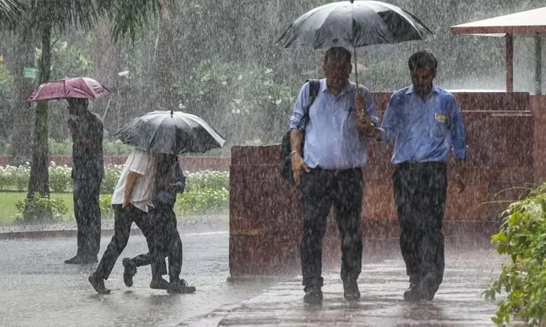
Very heavy rain forecast for Telugu states as low pressure nears
The meteorological centre has forecast very heavy rain in the Telugu states today and tomorrow due to a low-pressure system. Heavy to very heavy rain is likely in 13 Telangana districts, including Bhadradri Kothagudem, Khammam, Warangal and Karimnagar. APSDMA managing director Prakhar Jain said a cyclonic circulation extends to 5.8 km above sea level over the northeast Bay of Bengal and the Myanmar coast, with a low-pressure area likely over the north Bay of Bengal within 12 hours. Heavy rain is also expected in Visakhapatnam and Vizianagaram, with winds of 40-50 kmph along the coast; fishermen were advised against venturing out.
Source
Rajanna Sircilla — వాతావరణం · read the original report ↗
Desk check · compared with the source
What the desk checked (5)
- Very heavy rain likely in the Telugu states today and tomorrow due to a low-pressure system — Attributed in the source to the meteorological centre; forecast, not verifiable outcome.
- Heavy to very heavy rain likely in 13 Telangana districts including Bhadradri Kothagudem, Khammam and Warangal — District list appears in the source, attributed to the Hyderabad meteorological centre.
- A cyclonic circulation extends to 5.8 km above sea level over the northeast Bay of Bengal and adjoining Myanmar coast — Attributed to APSDMA MD Prakhar Jain; figure appears in the source.
- A low-pressure area is likely to form over the north Bay of Bengal in the next 12 hours — Source text says 12 hours in the body but 24 hours in the quoted APSDMA post — internal inconsistency an editor should resolve.
- Winds of 40-50 kmph along the coast; fishermen advised not to venture into the sea — Attributed to APSDMA MD in the source.
Analysts’ view opinion
This is a weather bulletin, but in the Telugu states monsoon emergencies almost always become a test of governance. Both the Telangana and Andhra Pradesh governments now have advance warning on record — which means any perceived delay in response opens them to the charge that they were told and did too little. Also worth noting is the difference in style: in AP the disaster management authority is out front with named, technical briefing, while in Telangana the IMD advisory itself is doing most of the talking.
- A warning covering 13 districts including Bhadradri Kothagudem, Khammam, Warangal and Karimnagar concentrates the relief burden on north Telangana and the Godavari belt, raising the stakes for the state government there.
- Technical details being issued publicly under APSDMA MD Prakhar Jain's name suggests the AP government is treating early-warning communication as an instrument of administrative credibility.
- The advisory against fishermen venturing out affects coastal livelihoods in Visakhapatnam, Vizianagaram and nearby districts, and compensation demands are a familiar political flashpoint after such advisories.
- Opposition parties in both states typically respond to weather emergencies with field visits and imagery from inundated areas — a playbook that gains traction only if the official response looks slow.
- The political upside or downside here will rest on execution, not announcements: low damage lets governments claim credit for preparedness, high damage invites accountability questions.
What to watch — Watch whether chief ministers and ministers in both states hold review meetings or make field visits over the next two days, and who moves first on seeking central assistance.
The story only reports a forecast and advisories — it does not establish what preparedness steps either government has actually taken, how the opposition has responded, or what damage has occurred.
Deep dive
Research brief · 8 facts · 3 dates · exam-readyThe brief
Context
The India Meteorological Department's Hyderabad centre and the Andhra Pradesh State Disaster Management Authority (APSDMA) have warned of very heavy rain across Telangana and Andhra Pradesh on 2 and 3 September 2025. The trigger is a cyclonic circulation over the northeast Bay of Bengal and the adjoining Myanmar coast, extending up to 5.8 km above sea level, which is expected to spawn a low-pressure area over the north Bay of Bengal. Such Bay of Bengal low-pressure systems are the main rain-bearing mechanism for the Telugu states during the southwest monsoon, and their westward movement typically brings intense spells inland.
Key facts
- Hyderabad meteorological centre forecast very heavy rain in the Telugu states on 2 and 3 September 2025 (story published 2 Sept 2025, 7:17 AM IST).
- Heavy to very heavy rain at isolated places forecast in 13 Telangana districts: Bhadradri Kothagudem, Hanumakonda, Jagtial, Jayashankar Bhupalpally, Karimnagar, Khammam, Mahabubabad, Mulugu, Nirmal, Nizamabad, Peddapalli, Rajanna Sircilla and Warangal.
- Heavy rain at isolated places forecast in 11 more Telangana districts: Adilabad, Jangaon, Kamareddy, Kumram Bheem Asifabad, Mancherial, Medak, Nalgonda, Sangareddy, Siddipet, Suryapet and Yadadri Bhuvanagiri.
- APSDMA MD Prakhar Jain said a cyclonic circulation over the northeast Bay of Bengal and adjoining Myanmar coast extends to 5.8 km above sea level.
- A low-pressure area was likely to form over the north Bay of Bengal within the next 12 hours (APSDMA's 1 September post said 24 hours).
- In Andhra Pradesh, heavy rain at isolated places was forecast for Vizianagaram, Alluri Sitharama Raju, Visakhapatnam and Anakapalli districts.
- Moderate to heavy rain forecast for Srikakulam, Parvathipuram Manyam, Kakinada, Konaseema, East Godavari, West Godavari, Eluru and NTR districts; light to moderate rain in Krishna, Guntur, Bapatla, Palnadu and Prakasam.
- Squally winds of 40-50 kmph were forecast along the coast and fishermen were advised not to venture into the sea.
Timeline
- 1 September 2025APSDMA posted that a cyclonic circulation over the northeast Bay of Bengal and Myanmar coast extends to 5.8 km, with a low-pressure area likely over the north Bay of Bengal in 24 hours.
- 2 September 2025 (story published 7:17 AM IST)Hyderabad meteorological centre forecast very heavy rain in the Telugu states for the day; APSDMA MD said the low-pressure area was likely within 12 hours.
- 2-3 September 2025 (today and tomorrow)Very heavy rain forecast across the Telugu states; district-wise heavy rain and 40-50 kmph coastal winds warnings issued.
Who has a stake
- Hyderabad meteorological centre (IMD) — Issues the district-wise rainfall forecasts and warnings for Telangana.
- Andhra Pradesh State Disaster Management Authority (APSDMA) and its MD Prakhar Jain — Tracks the system and communicates warnings and district-wise rain outlook for Andhra Pradesh.
- Residents of 24 named Telangana districts — Exposed to heavy to very heavy rain at isolated places on the forecast days.
- North coastal Andhra districts (Visakhapatnam, Vizianagaram, Alluri Sitharama Raju, Anakapalli) — Face heavy rain at isolated places along with squally coastal winds.
- Fishermen — Advised not to venture into the sea because of 40-50 kmph winds along the coast; loss of fishing days.
Why it matters
Bay of Bengal low-pressure systems drive the heaviest monsoon spells over the Telugu states, and advance district-level warnings decide how early local administrations, farmers and fishermen can act. With 13 Telangana districts under heavy to very heavy rain watch and 40-50 kmph winds along the Andhra coast, the alert bears directly on crop safety, urban flooding risk and coastal livelihoods.
UPSC angle
Prelims pointers
- A cyclonic circulation over the northeast Bay of Bengal and adjoining Myanmar coast extended to 5.8 km above sea level (per APSDMA, 1-2 Sept 2025).
- A low-pressure area was forecast to form over the north Bay of Bengal within 12 hours of 2 September 2025.
- APSDMA = Andhra Pradesh State Disaster Management Authority; its MD is Prakhar Jain (as stated in the source).
- 13 Telangana districts, including Bhadradri Kothagudem, Khammam, Warangal and Karimnagar, were placed under heavy to very heavy rain warning.
- Squally winds of 40-50 kmph were forecast along the Andhra coast, with a no-sea-venture advisory for fishermen.
Mains framing
The forecast illustrates how a single Bay of Bengal synoptic feature - a cyclonic circulation extending to 5.8 km above sea level over the northeast Bay and Myanmar coast - can escalate into a low-pressure area and deliver very heavy rain across two states within 24-48 hours. The implications are asymmetric: interior and northern Telangana districts such as Bhadradri Kothagudem, Khammam, Warangal and Karimnagar face inundation and crop damage risk during a critical kharif phase, while north coastal Andhra faces heavy rain plus 40-50 kmph squally winds that suspend fishing activity. The institutional response visible in the source is essentially forecast-and-advisory: IMD's Hyderabad centre issuing district-level warnings, and APSDMA relaying the system's evolution and the fishermen advisory through public channels, including social media. The way forward suggested by this pattern is tighter district-level dissemination so that warnings reach farmers and fishing hamlets in time, pre-positioning of response capacity in the districts flagged for very heavy rain, and clear communication of revisions - the source itself shows the low-pressure timeline being updated from 24 hours to 12 hours, underlining that such advisories are dynamic and need continuous public updating.
Key terms
- Low-pressure area (alpapeedanam)
- A region of relatively low atmospheric pressure over the sea that draws in moist winds and typically brings widespread heavy rain inland.
- Cyclonic circulation (upari-tala aavartanam)
- A rotating wind pattern in the atmosphere, here extending to 5.8 km above sea level, that can intensify into a low-pressure system.
- APSDMA
- Andhra Pradesh State Disaster Management Authority, the state body that monitors hazards and issues public warnings and advisories.
- Very heavy rain
- An IMD rainfall warning category used here for the highest-intensity spells forecast over the Telugu states on 2-3 September 2025.
- Squally winds
- Sudden strong winds, forecast at 40-50 kmph along the coast, on which the advisory against fishermen venturing to sea was based.
Practice questions
- How do low-pressure systems forming over the Bay of Bengal influence rainfall distribution over the Telugu states during the southwest monsoon?
- Discuss the role of state disaster management authorities such as APSDMA in translating meteorological forecasts into actionable public advisories.
- Examine the livelihood impact of coastal wind warnings and no-sea-venture advisories on fishing communities, and suggest measures to cushion them.
Grounded only in the source report — figures and dates are the source's, not inferred.