
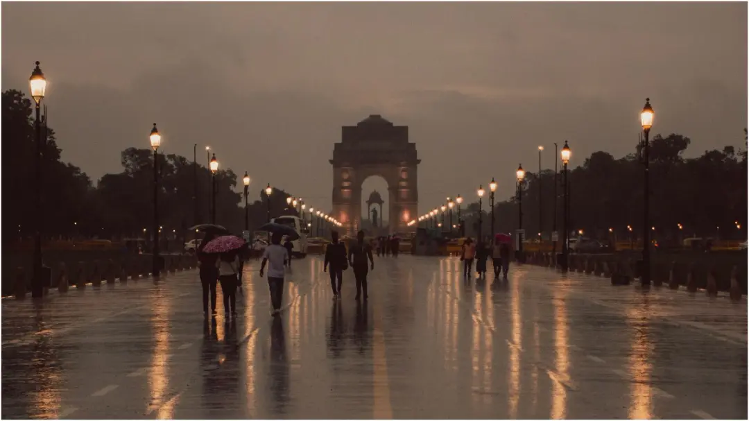
IMD warns of rain, thunderstorms across several states on September 28
The IMD has warned of rain, thunderstorms, lightning and strong winds in several states on September 28. Delhi-NCR may see partly cloudy skies, with a maximum temperature around 31 degrees Celsius and a minimum of 20. Eastern Uttar Pradesh recorded 30 cm or more rainfall at some places on September 27. Flash floods are possible in Uttarakhand. Winds of 40-50 kmph, gusting to 60 kmph, are likely in Assam and Meghalaya. Fishermen have been advised caution.
Source
Weather · read the original report ↗
Desk check · compared with the source
What the desk checked (5)
- IMD issued warnings of rain, thunderstorms, lightning and strong winds in several states for September 28. — Attributed to IMD in the source; no bulletin number or official quote given.
- Eastern Uttar Pradesh recorded 30 cm or more rainfall in some areas on September 27. — Figure appears in source, attributed to IMD data; no station names provided.
- Delhi-NCR maximum temperature around 31C and minimum 20C on September 28. — Figures appear in source as forecast; consistent with rest of text.
- Winds of 40-50 kmph, gusting to 60 kmph, likely in Assam and Meghalaya from September 28-30. — Figure appears in source; attributed to the weather department forecast.
- Sea conditions may remain rough off Somalia coast and southwest Arabian Sea until September 29; fishermen advised to check latest warnings. — Attributed to IMD advisory in source; no external verification possible.
Analysts’ view opinion
On its face this is a weather bulletin, but politically it is a test of administrative capacity. Rainfall of over 30 cm in eastern Uttar Pradesh, flash-flood risk in Uttarakhand and strong winds across the Northeast arriving together means Centre-state coordination and the speed of disaster response will quickly enter public debate. Once a formal warning is on record, governments lose the defence that nobody saw it coming.
- Any loss of life or crop damage that follows an IMD advance warning tends to be reframed politically as a failure of preparedness rather than an act of nature.
- In states such as Uttar Pradesh and Bihar, late-September rain overlaps with the crop cycle, so demands for damage assessment and compensation can become an immediate political agenda.
- The story describes relatively mild conditions for Delhi-NCR, which suggests national media attention and political pressure will centre on the hill and eastern states instead.
- In hill states like Uttarakhand and Himachal Pradesh, flash-flood and landslide risk routinely reopens opposition criticism over construction clearances and road projects.
- The fishermen's advisory pushes livelihood protection and relief support for coastal states into the political conversation.
What to watch — Watch how fast state governments and the Centre visibly deploy response teams and announce relief or compensation — that timing will shape the political argument that follows.
The story only sets out IMD forecasts and warnings; it establishes nothing about actual casualties, damage, government response or any political reaction in any state.
Deep dive
Research brief · 8 facts · 7 dates · exam-readyThe brief
Context
India's southwest monsoon has entered its withdrawal phase at the end of September, but weather systems continue to keep rainfall active across large parts of the country. The IMD has issued warnings for rain, thunderstorms, lightning and squally winds in several states for September 28, along with flash flood risk in Uttarakhand's hills and rough sea warnings for fishermen. Two low pressure areas — one over northern parts of central Uttar Pradesh and another near the south Myanmar coast — plus the withdrawing monsoon trough are driving the spell.
Key facts
- On September 27 the trough of the withdrawing monsoon ran through Gurdaspur, Chandigarh, Muzaffarnagar, Aligarh, Dholpur, Udaipur, Deesa and Nalia up to the Arabian Sea, per IMD.
- A low pressure area over northern parts of central Uttar Pradesh was to move north-northwestwards over the next 12 hours and weaken gradually.
- Another low pressure area formed near the south Myanmar coast, likely to move towards the north Andaman Sea, then the northeast Bay of Bengal and adjoining Bangladesh coast.
- Delhi-NCR on September 28: partly cloudy skies, light drizzle possible, maximum around 31 degrees Celsius and minimum around 20 degrees Celsius.
- Eastern Uttar Pradesh recorded extremely heavy rainfall on September 27, with 30 cm or more at some places; western UP also saw very heavy rain.
- Uttarakhand and western Uttar Pradesh recorded 12 to 20 cm of very heavy rainfall on September 27.
- Flash flood risk over the next 24 hours in parts of Uttarkashi, Dehradun, Tehri Garhwal, Chamoli and Rudraprayag.
- Assam and Meghalaya may see winds of 40-50 kmph gusting to 60 kmph from September 28 to 30; central Maharashtra 30-40 kmph gusting to 50 kmph on September 28.
Timeline
- September 27Monsoon trough extends from Gurdaspur to the Arabian Sea; extremely heavy rain (30 cm or more) in east UP, 12-20 cm in Uttarakhand and west UP, very heavy rain in parts of Bihar.
- September 28IMD warning for rain, thunderstorms, lightning and strong winds in several states; partly cloudy Delhi-NCR; flash flood risk in five Uttarakhand districts; no heavy rain alert for UP.
- September 28 to 30Squally winds of 40-50 kmph gusting to 60 kmph over Assam and Meghalaya; rain in west Madhya Pradesh; rain continues in Kerala and Mahe.
- September 28 to October 1Rain and thunderstorms in Bihar, east Madhya Pradesh, Nagaland, Manipur, Mizoram, Tripura; heavy rain possible in south interior Karnataka.
- September 29Delhi skies relatively clear with slight temperature rise, northwesterly winds around 18 kmph in the afternoon; rough seas off Somalia coast and southwest Arabian Sea till this date; wider rain over coastal Karnataka.
- September 29 to October 1Winds of 30-40 kmph gusting to 50 kmph over Kerala and Mahe.
- October 1Rainfall activity expected to increase over Kerala and Mahe.
Who has a stake
- India Meteorological Department (IMD) — Issues the rain, thunderstorm, lightning, wind and rough-sea warnings and tracks the withdrawing monsoon trough and low pressure areas.
- Residents of Uttar Pradesh — Daily life disrupted and waterlogging after days of heavy rain; intensity expected to ease with no heavy rain alert on September 28.
- Hill communities in Uttarakhand and Himachal Pradesh — Face flash floods in Uttarkashi, Dehradun, Tehri Garhwal, Chamoli, Rudraprayag; landslide and road blockage risk in Kinnaur, Shimla, Sirmaur.
- Fishermen — Advised to check latest IMD warnings before venturing out as seas may be rough off Somalia, southwest Arabian Sea, north Andaman Sea and Myanmar-Bangladesh coasts.
- Northeast and peninsular states — Assam, Meghalaya, Nagaland, Manipur, Mizoram, Tripura, Kerala, Karnataka, Tamil Nadu face squally winds, thunderstorms and lightning.
Why it matters
Late-September rainfall during monsoon withdrawal often brings the most damaging localised extremes — 30 cm in a day in east UP, flash floods in Himalayan districts and landslides on hill roads. Advance IMD warnings on winds, lightning and rough seas are the main tool for protecting fishermen, travellers and standing kharif crops at harvest time.
UPSC angle
Prelims pointers
- Southwest monsoon was in its withdrawal phase in late September; withdrawal is tracked by the position of the monsoon trough.
- On September 27 the trough ran through Gurdaspur, Chandigarh, Muzaffarnagar, Aligarh, Dholpur, Udaipur, Deesa and Nalia to the Arabian Sea.
- Rainfall of 30 cm or more in a day is classified in IMD reporting as extremely heavy rainfall (recorded in east UP on September 27).
- Uttarakhand flash flood risk districts named: Uttarkashi, Dehradun, Tehri Garhwal, Chamoli, Rudraprayag.
- Assam and Meghalaya wind warning: 40-50 kmph gusting to 60 kmph, September 28-30.
- Rough sea warning areas: off Somalia coast, southwest Arabian Sea, north Andaman Sea, and near Myanmar and Bangladesh coasts.
Mains framing
The September 28 IMD bulletin illustrates how the withdrawal phase of the southwest monsoon can be as hazardous as its peak: even as the trough shifts towards the Arabian Sea, a low pressure area over northern central Uttar Pradesh and a second system near the south Myanmar coast keep rainfall active from the Gangetic plains to the northeast and peninsula. The consequences are differentiated by geography — extremely heavy rain (30 cm or more on September 27 in east UP) causes urban waterlogging and disruption in the plains; 12-20 cm over Uttarakhand translates into flash floods in Uttarkashi, Dehradun, Tehri Garhwal, Chamoli and Rudraprayag and landslide-blocked roads in Kinnaur, Shimla and Sirmaur; squally winds of up to 60 kmph over Assam and Meghalaya and 50 kmph gusts over central Maharashtra and Kerala threaten power lines, transport and lives through lightning; and rough seas over the Arabian Sea and Bay of Bengal endanger fishing fleets. The way forward implied by the source is essentially warning-led: state-wise and district-level alerts, day-wise wind and rainfall forecasts, and the advisory that fishermen consult the latest IMD warnings before sailing — with preparedness for flash floods and landslides where hill rainfall is heavy.
Key terms
- IMD
- India Meteorological Department, the national agency that forecasts weather and issues rain, thunderstorm, wind and sea-state warnings.
- Monsoon trough
- An elongated low pressure zone whose position guides monsoon rain; on September 27 it ran from Gurdaspur to the Arabian Sea.
- Low Pressure Area
- A weather system of relatively low atmospheric pressure that draws in moisture and triggers rain; two were active — over central UP and near the Myanmar coast.
- Flash flood
- Sudden, rapid flooding after intense rain, flagged for parts of five Uttarakhand districts within 24 hours.
- Squally winds
- Sudden strong winds, forecast at 40-50 kmph gusting to 60 kmph over Assam and Meghalaya during September 28-30.
Practice questions
- How do weather systems during the withdrawal phase of the southwest monsoon produce extreme localised rainfall events? Illustrate with the IMD's September 28 warnings.
- Discuss the vulnerability of Himalayan districts such as Uttarkashi, Chamoli and Rudraprayag to flash floods and landslides during heavy rainfall, and the role of early warning systems.
- Examine the importance of IMD marine and wind warnings for fishermen and coastal livelihoods, with reference to the rough sea advisories for the Arabian Sea and Bay of Bengal.
Grounded only in the source report — figures and dates are the source's, not inferred.