
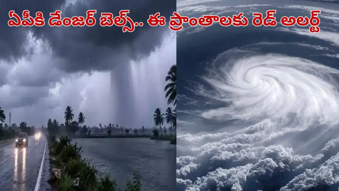
Deep depression to cross Andhra coast near Kalingapatnam
The depression over the Bay of Bengal is moving west at 18 kmph and lay 200 km east-southeast of Kalingapatnam and 290 km east of Visakhapatnam, the IMD Amaravati centre said. It is likely to intensify into a deep depression within 12 hours and cross the coast near Kalingapatnam on Wednesday night or early Thursday. Coastal Andhra and Yanam may get extremely heavy rain with winds up to 60 kmph. Officials warned fishermen against venturing out.
Source
ఆంధ్రప్రదేశ్ వార్తలు — Andhra Pradesh · read the original report ↗
Desk check · compared with the source
What the desk checked (5)
- The depression is moving west at 18 kmph and lay 200 km east-southeast of Kalingapatnam, 290 km east of Visakhapatnam and 200 km southeast of Gopalpur (Odisha). — Figures appear in the source and are attributed to the IMD Amaravati centre; internally consistent.
- It will intensify into a deep depression within 12 hours and cross the coast near Kalingapatnam on Wednesday night or early Thursday. — Attributed to IMD forecast in the source; forecast-based and subject to revision.
- A trough runs from the southeast Arabian Sea across Coastal Andhra at 3.1 to 7.6 km above mean sea level. — Technical detail stated in the source without a named official; consistent with the bulletin framing.
- Winds of 40 kmph rising to 50-60 kmph are expected along the coast; 40-50 kmph in Rayalaseema on Wednesday. — Figures appear in the source, attributed to the weather centre.
- Srikakulam, Vizianagaram and Visakhapatnam administrations are on alert, fishermen barred from venturing out and rescue teams deployed. — Attributed to officials collectively; no individual official named.
Analysts’ view opinion
This is a weather story, but on the Andhra coast storm events almost always become political tests. A deep depression crossing near Kalingapatnam puts the administrative response in Srikakulam, Vizianagaram and Visakhapatnam directly under public gaze. How visibly and quickly the machinery performs on early warnings, fishermen advisories and relief deployment will shape the political narrative of the coming weeks more than the storm itself.
- Because the impact is concentrated in north coastal districts, local elected representatives will face strong pressure to be visibly present on the ground.
- Fishing communities are an electorally significant bloc along the coast, and a ban on venturing out can quickly turn lost earnings into compensation demands.
- Smooth Centre-State coordination on disaster response tends to benefit both sides; any delay in relief typically becomes a blame-shifting argument.
- Opposition criticism in such episodes usually targets post-landfall handling — waterlogging, crop loss, power outages — rather than the storm's arrival.
- No party statements or political reactions are recorded in this story; it is purely at the administrative preparedness stage.
What to watch — Watch the speed of damage assessment for crops and homes after landfall, and how quickly any compensation or relief announcements follow.
The story establishes only IMD forecasts and official warnings — it does not establish any actual damage, nor how any leader or party has responded.
Deep dive
Research brief · 8 facts · 6 dates · exam-readyThe brief
Context
A depression that formed over the Bay of Bengal is strengthening as it races towards the Andhra Pradesh coast. The India Meteorological Department's Amaravati centre says the system, currently over the west-central and northwest Bay of Bengal, will become a deep depression within 12 hours and cross the coast near Kalingapatnam in Srikakulam district. A strong trough running from the southeast Arabian Sea across coastal Andhra up to the depression's circulation is expected to widen the rainfall spread across the state for three days.
Key facts
- The depression over the west-central and northwest Bay of Bengal has been moving westward at 18 kmph in recent hours.
- It was centred 200 km east-southeast of Kalingapatnam, 290 km east of Visakhapatnam and 200 km southeast of Gopalpur in Odisha.
- IMD Amaravati centre said the system would move west-northwestwards and intensify into a deep depression within 12 hours.
- Landfall is likely near Kalingapatnam on Wednesday night or early Thursday morning.
- A strong trough runs from the southeast Arabian Sea across coastal Andhra to the depression's circulation, between 3.1 km and 7.6 km above mean sea level.
- Coastal Andhra and Yanam may see heavy to very heavy rain on Tuesday and Wednesday, with extremely heavy rain at one or two places.
- Winds along the coast are expected to start at 40 kmph and gradually rise to 50-60 kmph, making the sea rough.
- Rayalaseema may get light to moderate rain on Tuesday with heavy rain and thunderstorms at one or two places, and winds of 40-50 kmph on Wednesday.
Timeline
- Recent hours (before the advisory)Depression over west-central and northwest Bay of Bengal moves west at 18 kmph, 200 km east-southeast of Kalingapatnam.
- Next 12 hoursSystem expected to move west-northwestwards and intensify into a deep depression.
- TuesdayModerate rain in many parts of coastal Andhra; light to moderate rain across Rayalaseema with heavy rain at one or two places.
- WednesdayHeavy to very heavy and isolated extremely heavy rain in coastal Andhra; winds of 40-50 kmph in Rayalaseema.
- Wednesday night or early ThursdayDeep depression likely to cross the coast near Kalingapatnam.
- Day after WednesdayHeavy rain continues at several places in coastal Andhra; rain intensity gradually eases in Rayalaseema to light showers.
Who has a stake
- IMD Amaravati centre — Issuing the tracking, intensification and landfall forecasts and district-level rainfall and wind warnings.
- Fishermen — Warned not to venture out to sea as it will turn rough during the deep depression's approach.
- District administrations of Srikakulam, Vizianagaram and Visakhapatnam — Placed on alert; relief teams deployed to handle emergencies.
- Residents of low-lying areas — Asked to stay alert and avoid sheltering under trees or near electricity poles.
- Yanam and coastal Andhra communities — Face extremely heavy rain and gusty winds up to 60 kmph.
- Rayalaseema residents — Face thunderstorms, heavy rain at isolated places and winds of 40-50 kmph before conditions ease.
Why it matters
Kalingapatnam on the north Andhra coast is a recurring landfall point for Bay of Bengal systems, and a deep depression there can bring extremely heavy rain, rough seas and disruption across Srikakulam, Vizianagaram and Visakhapatnam. Accurate lead time from the IMD allows fishing bans, relief team deployment and warnings to low-lying settlements before landfall. For the wider state, the accompanying trough means three days of widespread rain, affecting agriculture and daily life well beyond the coast.
UPSC angle
Prelims pointers
- The system was centred 200 km east-southeast of Kalingapatnam, 290 km east of Visakhapatnam and 200 km southeast of Gopalpur (Odisha).
- Kalingapatnam, the projected landfall point, lies in Srikakulam district of Andhra Pradesh.
- Yanam, grouped with coastal Andhra in the IMD warning, is part of the Union Territory of Puducherry.
- The trough extended from the southeast Arabian Sea to the depression's circulation at 3.1-7.6 km above mean sea level.
- Forecast coastal wind speeds: 40 kmph rising to 50-60 kmph; Rayalaseema 40-50 kmph on Wednesday.
- Alerted districts: Srikakulam, Vizianagaram and Visakhapatnam.
Mains framing
Bay of Bengal low-pressure systems intensifying into depressions and deep depressions are a recurring feature of Andhra Pradesh's coastal weather, and this case shows how forecast-based governance works in practice: the IMD Amaravati centre tracked a depression moving west at 18 kmph, projected intensification into a deep depression within 12 hours and a landfall near Kalingapatnam on Wednesday night or early Thursday, allowing administrations in Srikakulam, Vizianagaram and Visakhapatnam to issue fishing warnings and deploy relief teams in advance. The hazard is compounded by a strong trough from the southeast Arabian Sea at 3.1-7.6 km above mean sea level, which spreads heavy rain beyond the landfall zone into Rayalaseema and sustains three days of disturbed weather statewide. Implications include extremely heavy rain at isolated places, rough seas, loss of fishing days, risk to low-lying habitations and hazards from trees and electricity poles. The way forward, as reflected in the official response in the source, rests on early and localised warnings, enforcement of no-fishing advisories, pre-positioned rescue teams and public compliance with safety instructions in low-lying areas.
Key terms
- Depression
- A low-pressure system over the sea; here it formed over the Bay of Bengal and moved west at 18 kmph.
- Deep depression
- The next stage of intensification after a depression; the Bay system was expected to reach it within 12 hours.
- Trough
- An elongated zone of low pressure; here it ran from the southeast Arabian Sea over coastal Andhra at 3.1-7.6 km above mean sea level.
- IMD Amaravati centre
- The India Meteorological Department office that issued the tracking, landfall and rainfall warnings for Andhra Pradesh.
- Kalingapatnam
- Coastal point in Srikakulam district near which the deep depression was forecast to cross the coast.
- Extremely heavy rain
- The highest rainfall category flagged in the warning, expected at one or two places in coastal Andhra and Yanam.
Practice questions
- Discuss how forecast systems such as the IMD's depression tracking help coastal districts reduce disaster losses, using the Kalingapatnam landfall warning as an example.
- Explain the stages of intensification of a Bay of Bengal low-pressure system and why a trough aloft can widen the rainfall footprint inland.
- Evaluate the adequacy of administrative measures — fishing bans, relief team deployment and public advisories — in responding to a deep depression on the north Andhra coast.
Grounded only in the source report — figures and dates are the source's, not inferred.